MyTopo
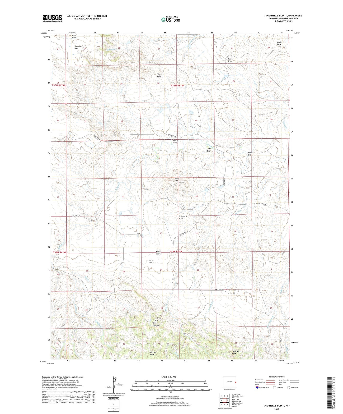
Shepherds Point Wyoming US Topo Map
Couldn't load pickup availability
2021 topographic map quadrangle Shepherds Point in the state of Wyoming. Scale: 1:24000. Based on the newly updated USGS 7.5' US Topo map series, this map is in the following counties: Niobrara. The map contains contour data, water features, and other items you are used to seeing on USGS maps, but also has updated roads and other features. This is the next generation of topographic maps. Printed on high-quality waterproof paper with UV fade-resistant inks.
Quads adjacent to this one:
West: Hat Creek
Northwest: Coyote Gap
North: South Oat Creek
Northeast: Oat Creek
East: Sherrill Hills
Southeast: Kirtley
South: Kirtley SW
Southwest: Signature Rock
This map covers the same area as the classic USGS quad with code o42104h2.
Contains the following named places: Cedar Draw, Clifton Number 1 Dam, Clifton Number 1 Reservoir, East Niobrara Division, Fitzsimmons Creek, Indian Creek School, Middle Creek, Mill Creek, Sand Draw, Seaman Hills, Shepherds Point, Spring Draw, Swanski Creek, Swanski Rock, Table Mountain, The Point, Thomas Dam, Thomas Reservoir, Thompson Dam, Thompson Number 2 Dam, Thompson Number 2 Reservoir, Thompson Reservoir, Three Tubs