MyTopo
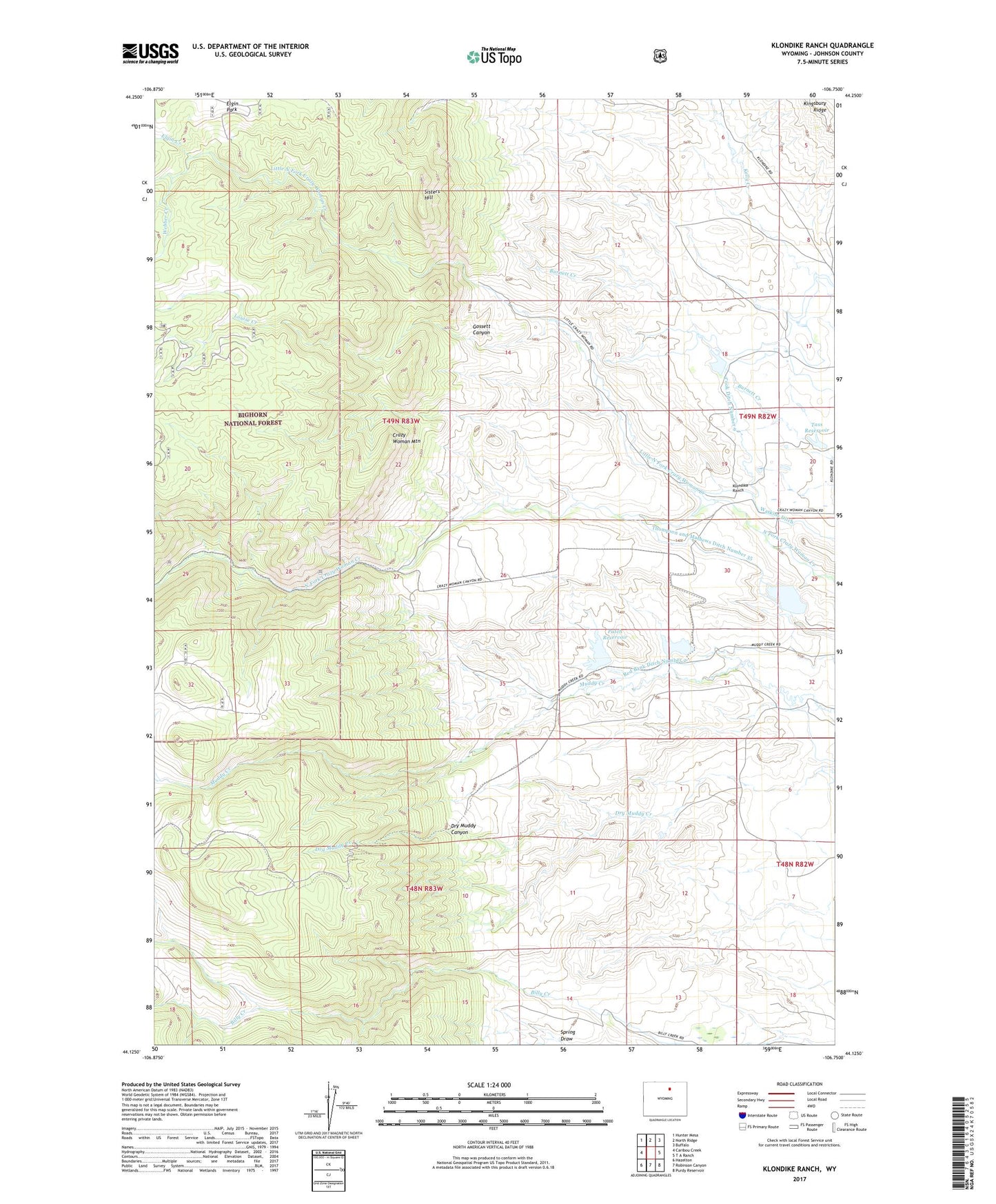
Klondike Ranch Wyoming US Topo Map
Couldn't load pickup availability
2021 topographic map quadrangle Klondike Ranch in the state of Wyoming. Scale: 1:24000. Based on the newly updated USGS 7.5' US Topo map series, this map is in the following counties: Johnson. The map contains contour data, water features, and other items you are used to seeing on USGS maps, but also has updated roads and other features. This is the next generation of topographic maps. Printed on high-quality waterproof paper with UV fade-resistant inks.
Quads adjacent to this one:
West: Caribou Creek
Northwest: Hunter Mesa
North: North Ridge
Northeast: Buffalo
East: T A Ranch
Southeast: Purdy Reservoir
South: Robinson Canyon
Southwest: Hazelton
Contains the following named places: Big Horn Mountains Number One Mine, Blue Gap Ditch Number 19, Cook Ditch Number 9, Crazy Woman Mountain, Dry Muddy Canyon, Elgin Creek, Elgin Park, Gossett Canyon, Gossett Creek, Kingsbury Ridge, Klondike Ranch, Little North Fork Crazy Woman Creek, Louise Creek, Muddy Creek Mine, Muddy Guard Reservoir Number 1, Muddy Guard Reservoir Number 1 Dam, Muddy Guard Reservoir Number 2, Muddy Guard Reservoir Number 2 Dam, Muffie Dam, Muffie Reservoir, Patch Dam, Patch Reservoir, Red Bank Ditch Number 2, Rice Ditch Number 1, Roe Brothers Group Mine, Sisters Hill, Sisters Hill Mine, Tass Dam, Tass Reservoir, Thompson and Mathews Ditch Number 35, Webber Creek