MyTopo
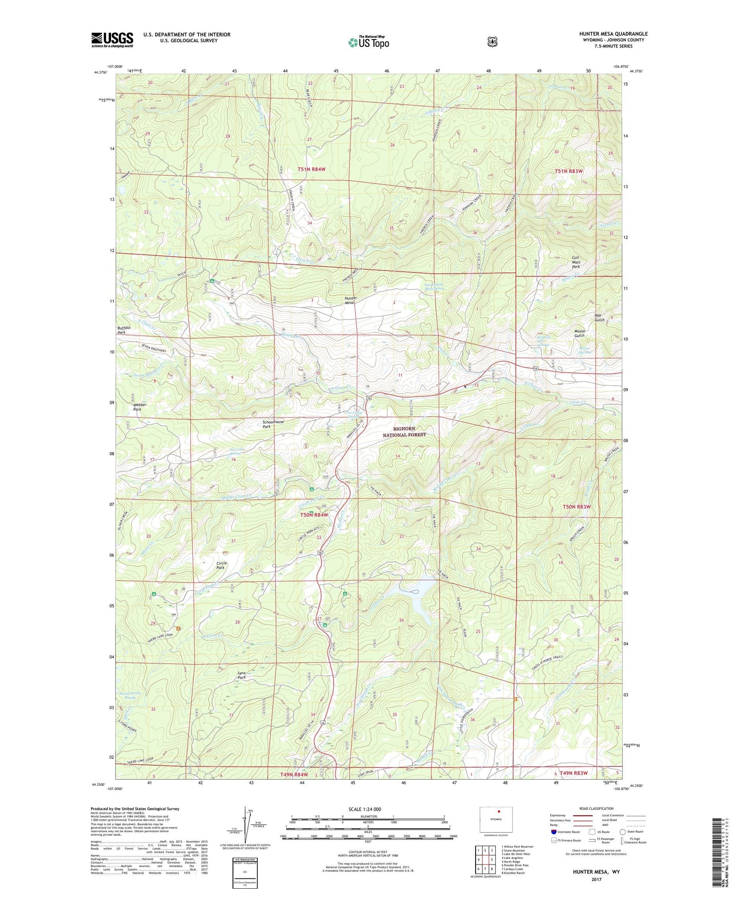
Hunter Mesa Wyoming US Topo Map
Couldn't load pickup availability
Also explore the Hunter Mesa Forest Service Topo of this same quad for updated USFS data
2021 topographic map quadrangle Hunter Mesa in the state of Wyoming. Scale: 1:24000. Based on the newly updated USGS 7.5' US Topo map series, this map is in the following counties: Johnson. The map contains contour data, water features, and other items you are used to seeing on USGS maps, but also has updated roads and other features. This is the next generation of topographic maps. Printed on high-quality waterproof paper with UV fade-resistant inks.
Quads adjacent to this one:
West: Lake Angeline
Northwest: Willow Park Reservoir
North: Stone Mountain
Northeast: Lake De Smet West
East: North Ridge
Southeast: Klondike Ranch
South: Caribou Creek
Southwest: Powder River Pass
This map covers the same area as the classic USGS quad with code o44106c8.
Contains the following named places: Buffalo Park, Circle Park, Circle Park Campground, Circle Park Creek, County Youth Camp, Cow Camp Spring, Cross H Cow Camp, Cull Watt Park, Duck Creek, East Hunter Mesa Spring, Foot Creek, Fox Cabin Spring, French Creek Cow Camp, Hettinger Picnic Area, Hondo Creek, Hospital Hill Springs, Hunter Corral, Hunter Creek, Hunter Mesa, Hunter Ranger Station, Little Sourdough Creek, Lucasta Camp, Lynx Park, Middle Clear Creek, Middle Fork Campground, Mosier Springs, North Clear Creek, North Fork Picnic Area, Oliver Creek, Paradise Ranch, Rabbit Creek, Schoolhouse Park, Seven Brothers Creek, Sourdough Campground, Sourdough Creek, South Clear Creek, South Fork Campground, The Pines, Tie Hack Campground, Webber Park