MyTopo
Purdy Reservoir Wyoming US Topo Map
Couldn't load pickup availability
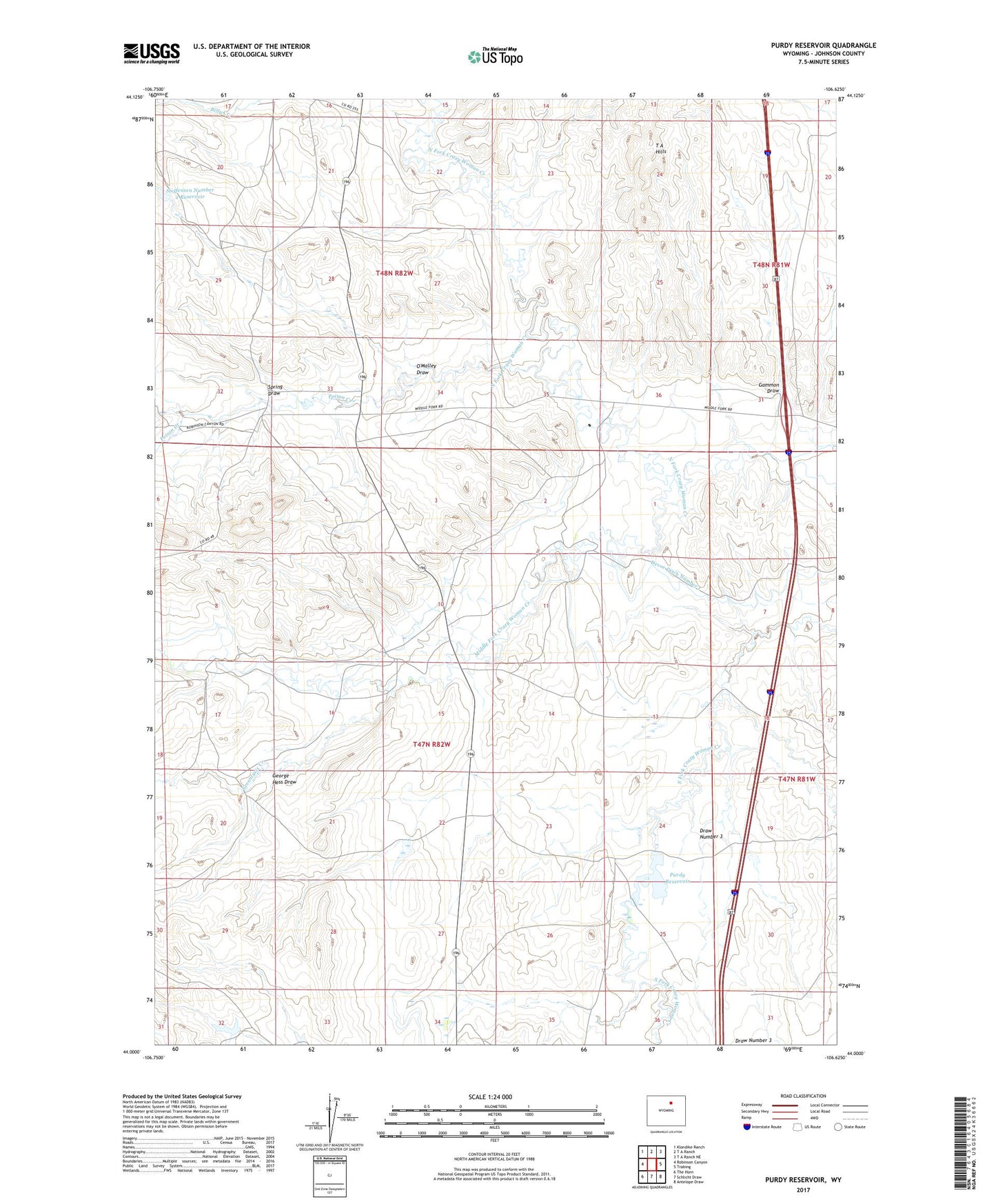
2021 topographic map quadrangle Purdy Reservoir in the state of Wyoming. Scale: 1:24000. Based on the newly updated USGS 7.5' US Topo map series, this map is in the following counties: Johnson. The map contains contour data, water features, and other items you are used to seeing on USGS maps, but also has updated roads and other features. This is the next generation of topographic maps. Printed on high-quality waterproof paper with UV fade-resistant inks.
Quads adjacent to this one:
West: Robinson Canyon
Northwest: Klondike Ranch
North: T A Ranch
Northeast: T A Ranch NE
East: Trabing
Southeast: Antelope Draw
South: Schlicht Draw
Southwest: The Horn
This map covers the same area as the classic USGS quad with code o44106a6.
Contains the following named places: 76 Number 2 Dam, 76 Number 2 Reservoir, Case Dam, Case Reservoir, Devoe Ditch Number 1, Doyen Dam, Doyen Reservoir, Draw Number 3, Dry Poison Creek, Dry Poison Dam, Dry Poison Irrigation Reservoir, Gammon Draw, George Hess Draw, Gunderman Pit, Lower Poison Creek Dam, Lower Poison Creek Stock Reservoir, Middle Fork Crazy Woman Creek, North Fork Crazy Woman Creek, O'Malley Draw, Poison Creek, Purdy Dam, Purdy Reservoir, Ramsbottom Dam, Ramsbottom Reservoir, Seventysix Creek, Spring Draw, Steffensen Dam, Steffensen Number 2 Reservoir, Steffensen Reservoir