MyTopo
Crystal Falls Wyoming US Topo Map
Couldn't load pickup availability
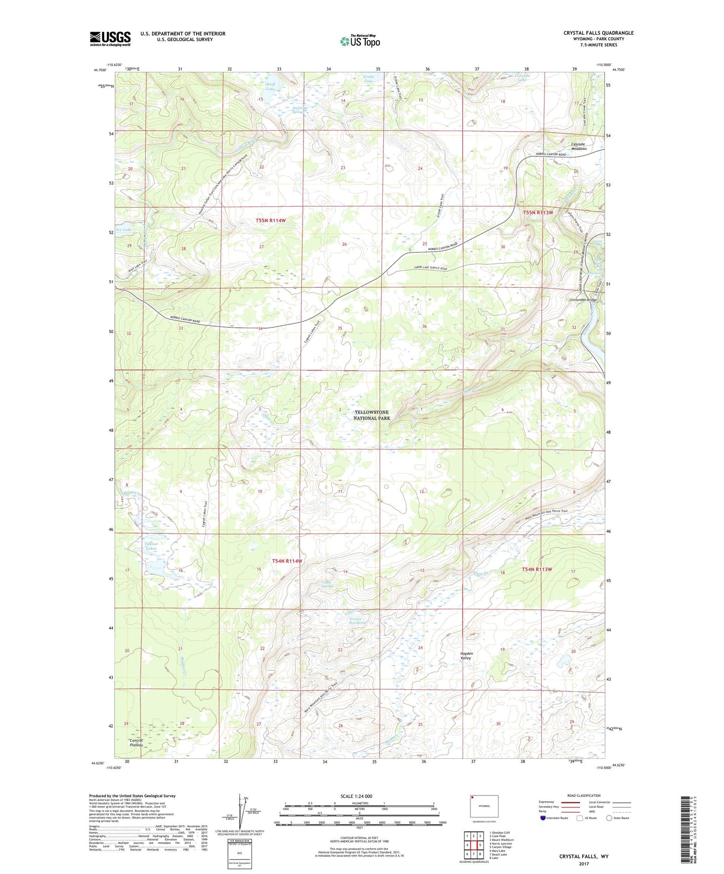
2021 topographic map quadrangle Crystal Falls in the state of Wyoming. Scale: 1:24000. Based on the newly updated USGS 7.5' US Topo map series, this map is in the following counties: Park. The map contains contour data, water features, and other items you are used to seeing on USGS maps, but also has updated roads and other features. This is the next generation of topographic maps. Printed on high-quality waterproof paper with UV fade-resistant inks.
Quads adjacent to this one:
West: Norris Junction
Northwest: Obsidian Cliff
North: Cook Peak
Northeast: Mount Washburn
East: Canyon Village
Southeast: Lake
South: Beach Lake
Southwest: Mary Lake
This map covers the same area as the classic USGS quad with code o44110f5.
Contains the following named places: Cascade Meadows, Chittenden Bridge, Crystal Falls, Cygnet Lakes, Otter Creek, Plateau Trail, Solfatara Plateau, Terrace Hot Spring, Violet Creek, Violet Springs, Wolf Lake, Wolf Lake Springs, Wolf Lake Trail