MyTopo
Lava Mountain Wyoming US Topo Map
Couldn't load pickup availability
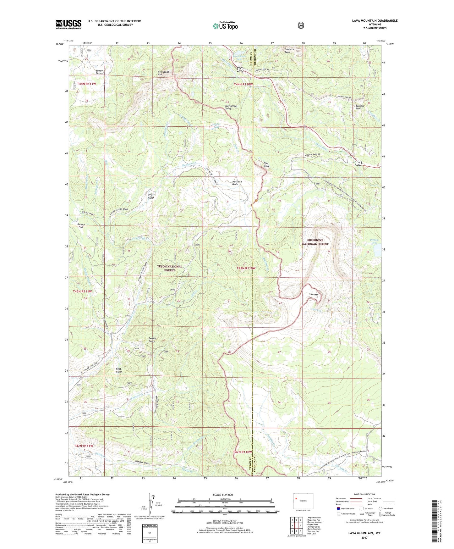
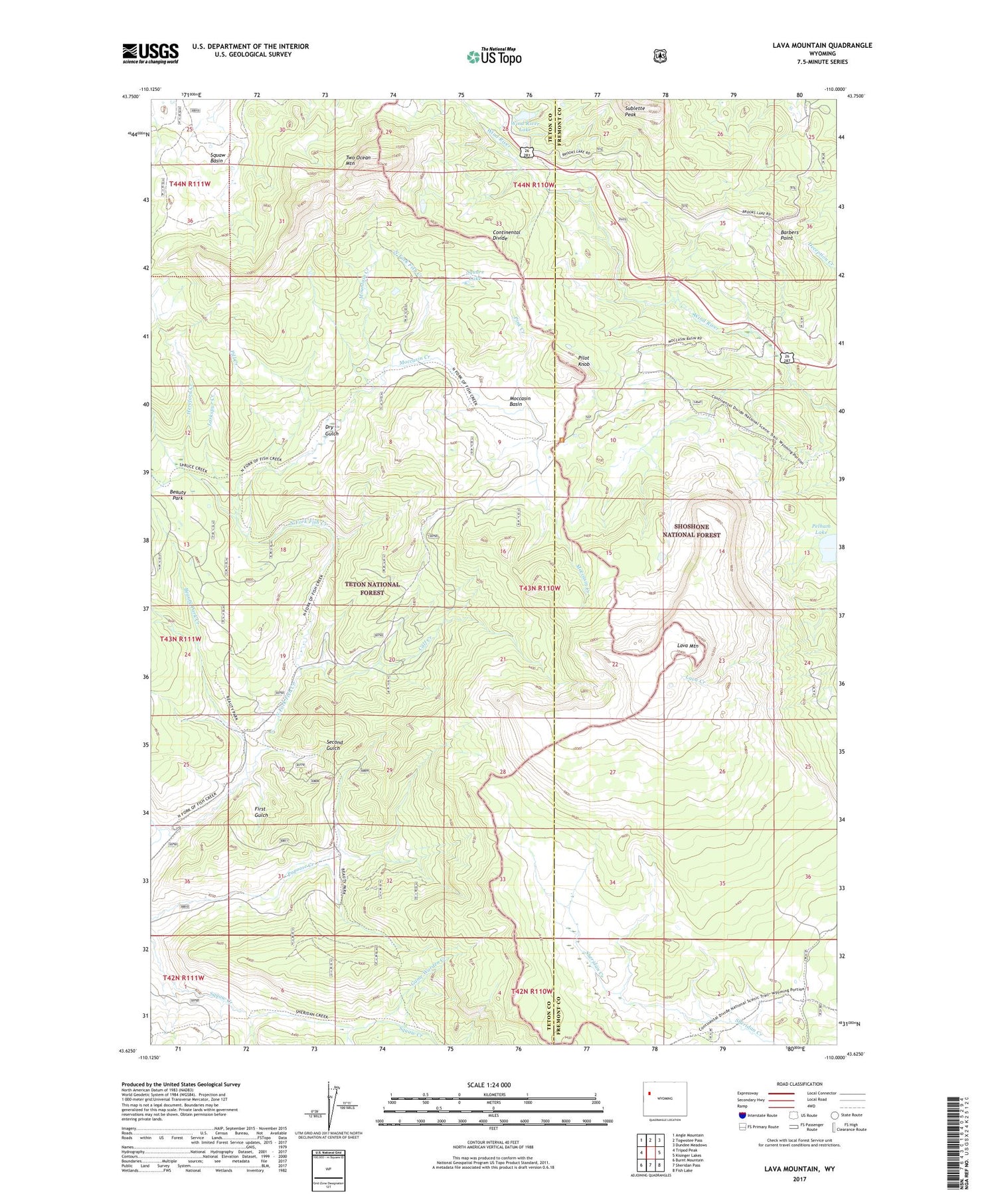
2021 topographic map quadrangle Lava Mountain in the state of Wyoming. Scale: 1:24000. Based on the newly updated USGS 7.5' US Topo map series, this map is in the following counties: Teton, Fremont. The map contains contour data, water features, and other items you are used to seeing on USGS maps, but also has updated roads and other features. This is the next generation of topographic maps. Printed on high-quality waterproof paper with UV fade-resistant inks.
Quads adjacent to this one:
West: Tripod Peak
Northwest: Angle Mountain
North: Togwotee Pass
Northeast: Dundee Meadows
East: Kisinger Lakes
Southeast: Fish Lake
South: Sheridan Pass
Southwest: Burnt Mountain
Contains the following named places: Barbers Point, Beauty Park, Beauty Park Creek, Brooks Lake Lodge, Burnt Fork, Calf Creek, Dry Gulch, First Gulch, Game Warden Creek, Hardscrabble Creek, Hereford Creek, Larkspur Creek, Lava Mountain, Lava Mountain Number One Mine, Moccasin Basin, Moccasin Creek, Mountain Creek, North Fish Creek Trail, Open Fork, Pelham Lake, Pill Creek, Pilot Knob, Pink Creek, Second Gulch, Spruce Creek Trail, Square Lake, Squaw Basin, Sublette Peak, Togwotee Pass, Two Ocean Mountain, Wind River Lake, Wind River Lake Picnic Area