MyTopo
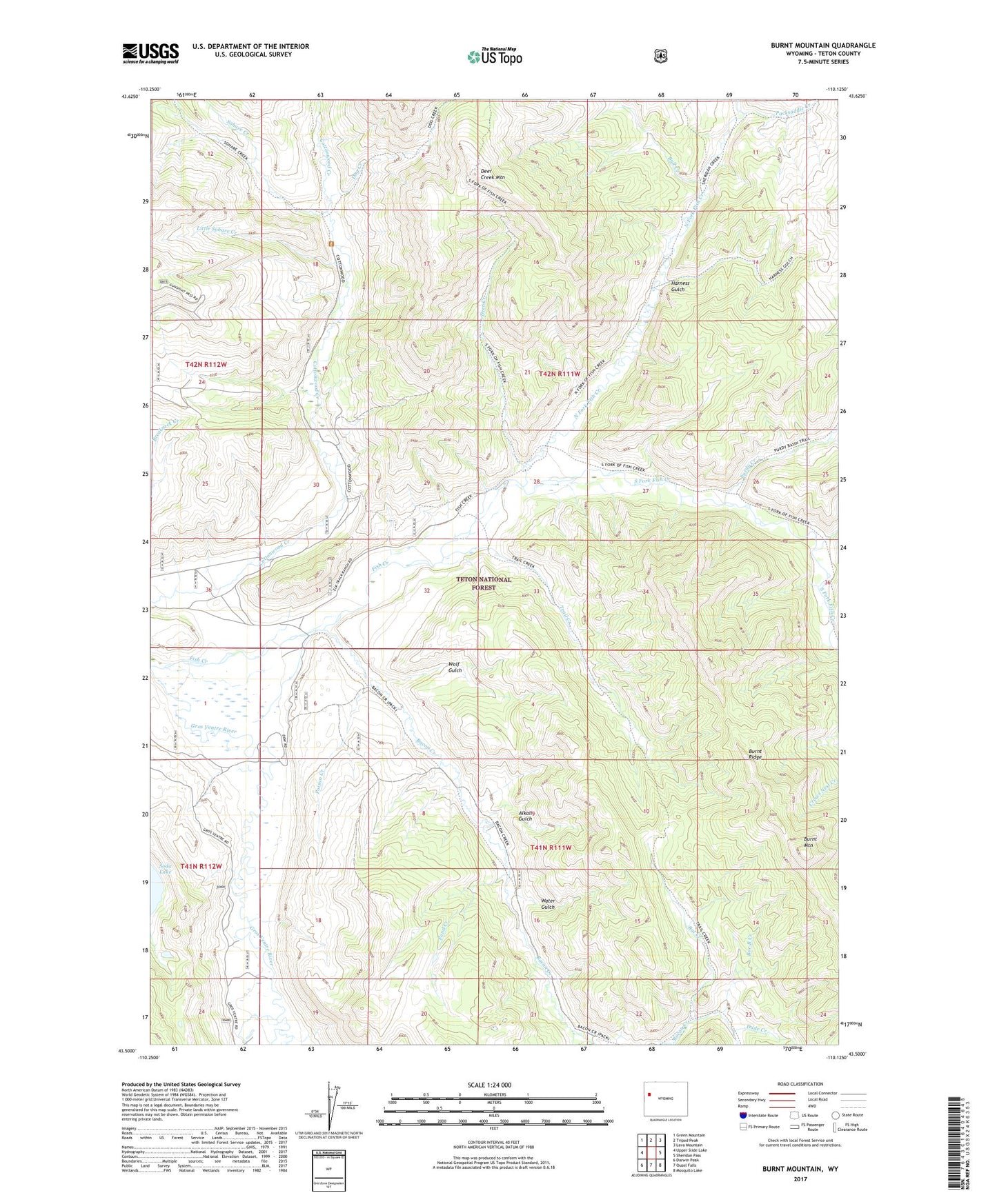
Burnt Mountain Wyoming US Topo Map
Couldn't load pickup availability
Also explore the Burnt Mountain Forest Service Topo of this same quad for updated USFS data
2021 topographic map quadrangle Burnt Mountain in the state of Wyoming. Scale: 1:24000. Based on the newly updated USGS 7.5' US Topo map series, this map is in the following counties: Teton. The map contains contour data, water features, and other items you are used to seeing on USGS maps, but also has updated roads and other features. This is the next generation of topographic maps. Printed on high-quality waterproof paper with UV fade-resistant inks.
Quads adjacent to this one:
West: Upper Slide Lake
Northwest: Green Mountain
North: Tripod Peak
Northeast: Lava Mountain
East: Sheridan Pass
Southeast: Mosquito Lake
South: Ouzel Falls
Southwest: Darwin Peak
This map covers the same area as the classic USGS quad with code o43110e2.
Contains the following named places: Alkali Gulch, Bacon Creek, Bang Creek, Bar B Creek, Bell Creek, Bridge Creek, Bull Creek, Bull Creek Patrol Cabin, Burnt Mountain, Burnt Ridge, Deer Creek, Deer Creek Lookout, Deer Creek Mountain, Dog Creek, Dude Creek, Falcona Claims Mine, Fish Creek, Hackamore Creek, Harness Gulch, Little Sohare Creek, North Fork Fish Creek, Packsaddle Creek, Poison Creek, Pond Creek, Purdy Basin Trail, Purdy Creek, Rat Creek, Sohare Creek, South Fork Fish Creek, Trail Creek, Water Gulch, Wolf Gulch