MyTopo
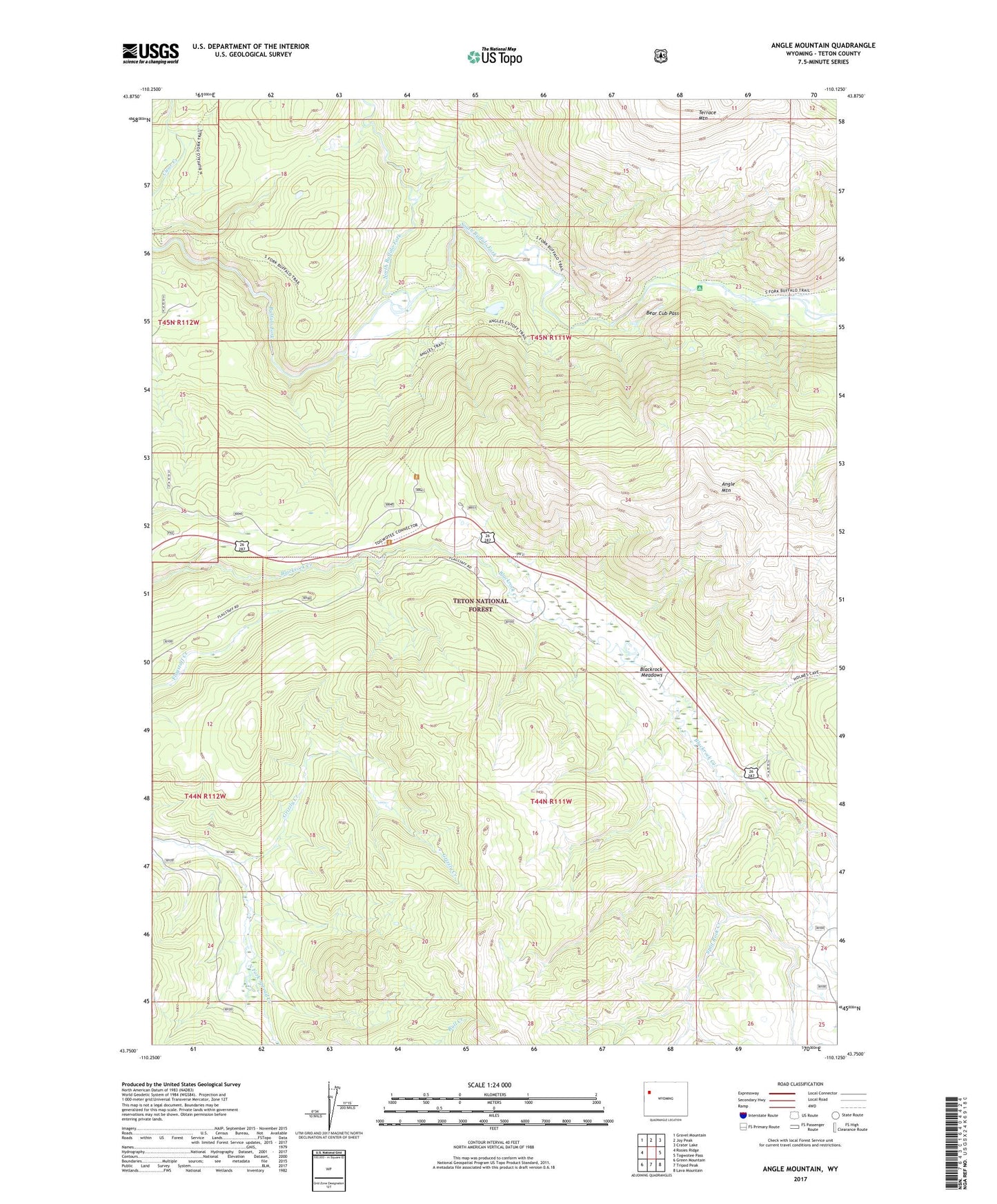
Angle Mountain Wyoming US Topo Map
Couldn't load pickup availability
Also explore the Angle Mountain Forest Service Topo of this same quad for updated USFS data
2023 topographic map quadrangle Angle Mountain in the state of Wyoming. Scale: 1:24000. Based on the newly updated USGS 7.5' US Topo map series, this map is in the following counties: Teton. The map contains contour data, water features, and other items you are used to seeing on USGS maps, but also has updated roads and other features. This is the next generation of topographic maps. Printed on high-quality waterproof paper with UV fade-resistant inks.
Quads adjacent to this one:
West: Rosies Ridge
Northwest: Gravel Mountain
North: Joy Peak
Northeast: Crater Lake
East: Togwotee Pass
Southeast: Lava Mountain
South: Tripod Peak
Southwest: Green Mountain
This map covers the same area as the classic USGS quad with code o43110g2.
Contains the following named places: Angle Mountain, Angles Trailhead, Bear Cub Pass, Black Rock Meadows Mine, Blackrock Meadows, Bull Creek, Clear Creek, Grizzly Creek, North Buffalo Fork, South Buffalo Fork, Split Rock Creek, Terrace Mountain, Togwatee Overlook, Togwotee Lodge