MyTopo
Leavitt Reservoir Wyoming US Topo Map
Couldn't load pickup availability
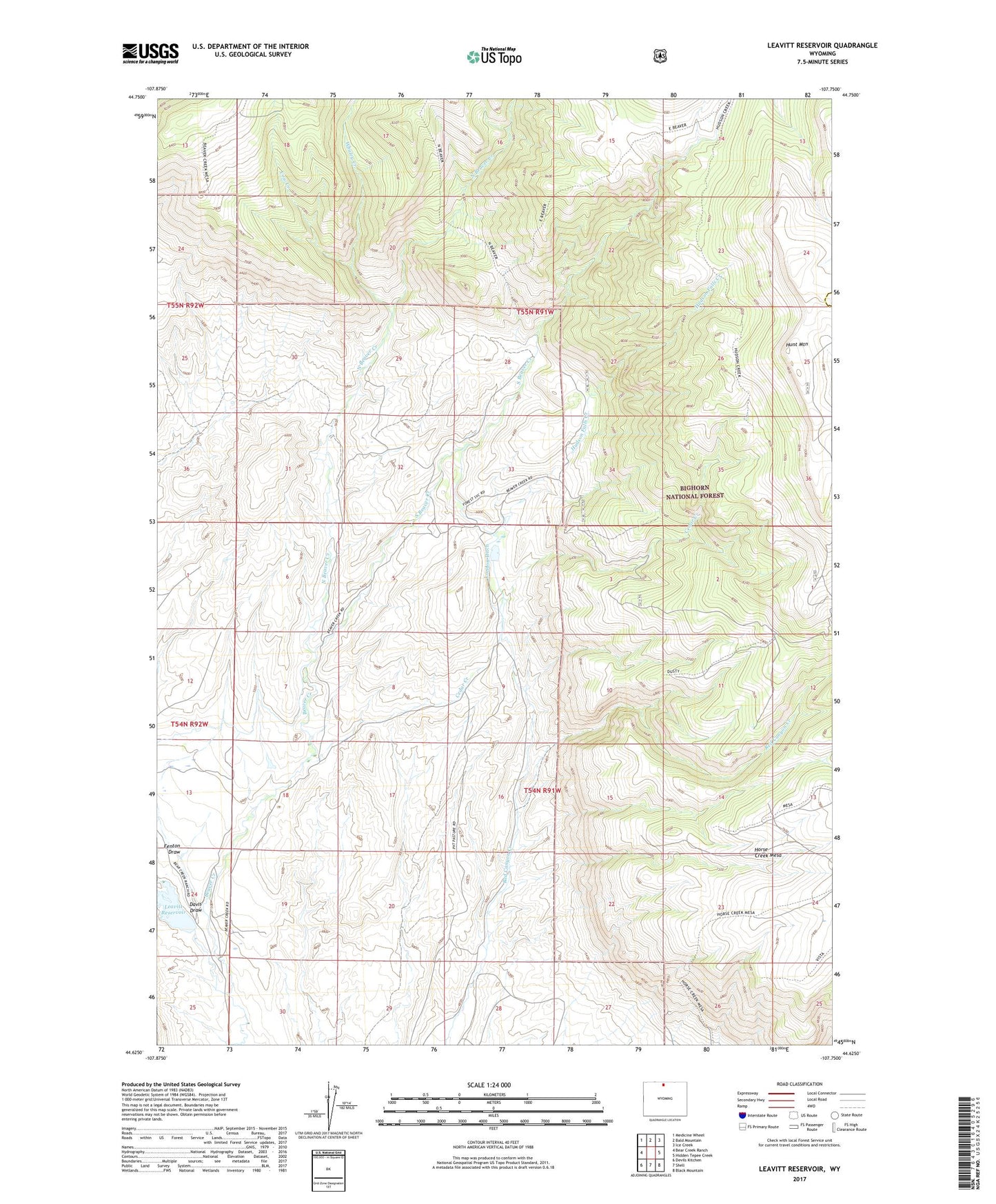
2021 topographic map quadrangle Leavitt Reservoir in the state of Wyoming. Scale: 1:24000. Based on the newly updated USGS 7.5' US Topo map series, this map is in the following counties: Big Horn, Sheridan. The map contains contour data, water features, and other items you are used to seeing on USGS maps, but also has updated roads and other features. This is the next generation of topographic maps. Printed on high-quality waterproof paper with UV fade-resistant inks.
Quads adjacent to this one:
West: Bear Creek Ranch
Northwest: Medicine Wheel
North: Bald Mountain
Northeast: Ice Creek
East: Hidden Tepee Creek
Southeast: Black Mountain
South: Shell
Southwest: Devils Kitchen
Contains the following named places: Beaver Creek Mine, Cedar Creek, Cow Creek, Davis Draw, Fenton Draw, Hudson Falls Creek, Hunt Mountain, Leavitt Dam, Leavitt Ranch, Leavitt Reservoir, London Ditch, North Beaver Creek, South Beaver Creek, Whaley Creek, ZIP Code: 82441