MyTopo
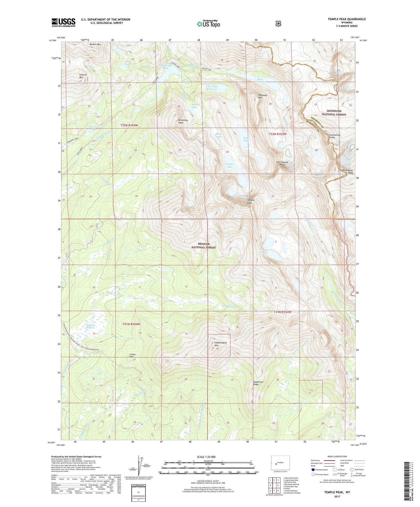
Temple Peak Wyoming US Topo Map
Couldn't load pickup availability
Also explore the Temple Peak Forest Service Topo of this same quad for updated USFS data
2023 topographic map quadrangle Temple Peak in the state of Wyoming. Scale: 1:24000. Based on the newly updated USGS 7.5' US Topo map series, this map is in the following counties: Sublette, Fremont. The map contains contour data, water features, and other items you are used to seeing on USGS maps, but also has updated roads and other features. This is the next generation of topographic maps. Printed on high-quality waterproof paper with UV fade-resistant inks.
Quads adjacent to this one:
West: Big Sandy Opening
Northwest: Mount Bonneville
North: Lizard Head Peak
Northeast: Dickinson Park
East: Sweetwater Gap
Southeast: Sweetwater Needles
South: Jensen Meadows
Southwest: Leckie
This map covers the same area as the classic USGS quad with code o42109f2.
Contains the following named places: Big Sandy Lake, Big Sunday Trail, Black Joe Creek, Black Joe Lake, Blue Lake, Bunion Mountain, Clear Lake, Clear Lake Dam, Clear Lake Reservoir, Crows Nest, Crows Nest Trail, Deep Lake, Diamond Lake, East Temple Peak, Frozen Lakes, Haystack Mountain, Independent Mountain, Laturio Mountain, Lost Creek, Miller Lake, North Creek, North Temple Creek, Popo Agie Primitive Area, Rapid Creek, Rapid Lake, Sagebrush Ridge, Schiestler Peak, Sedgewick Meadows, Temple Lake, Temple Peak, Temple Peak Deposit, Wind River Peak