MyTopo
Linch Wyoming US Topo Map
Couldn't load pickup availability
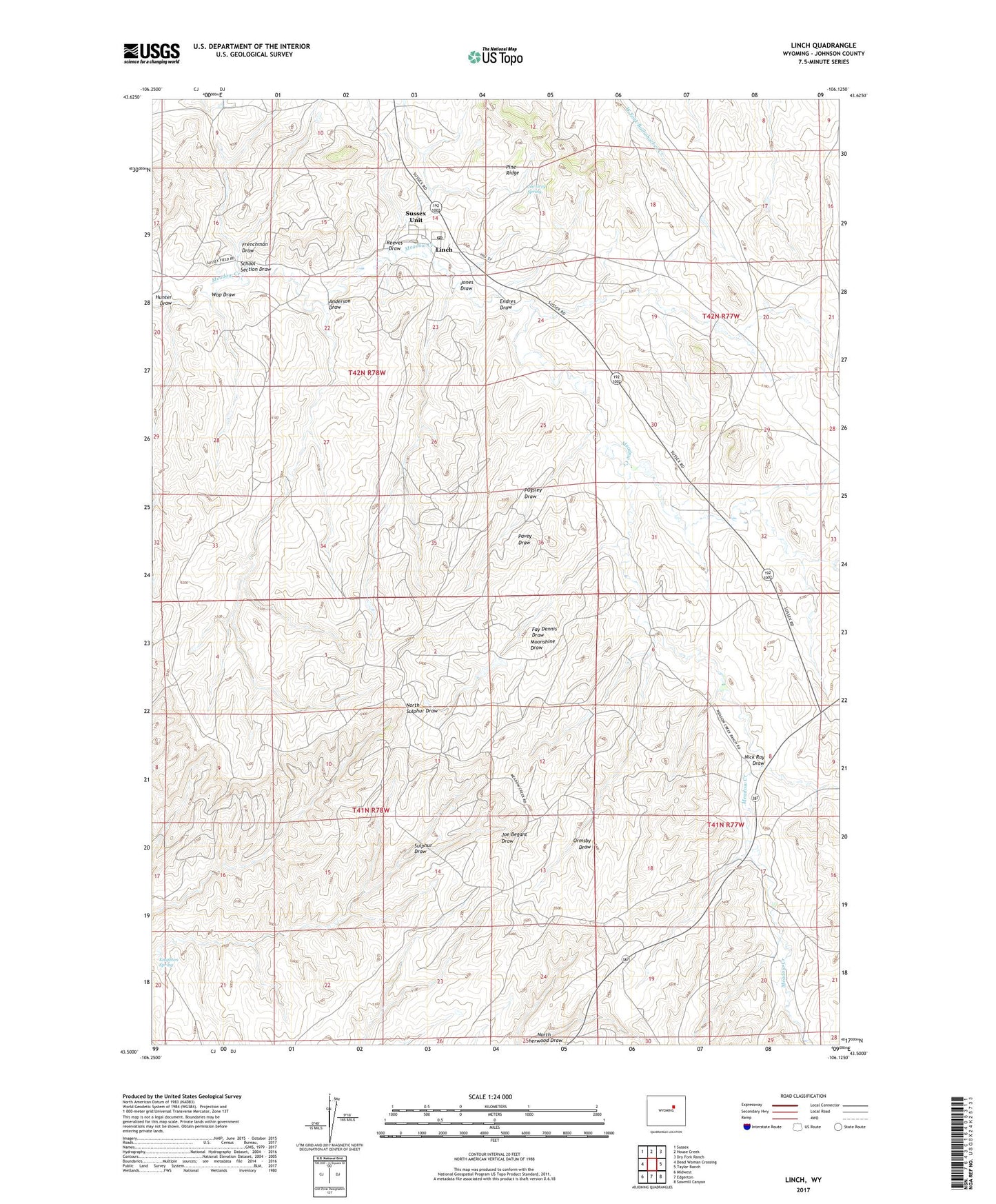
2021 topographic map quadrangle Linch in the state of Wyoming. Scale: 1:24000. Based on the newly updated USGS 7.5' US Topo map series, this map is in the following counties: Johnson. The map contains contour data, water features, and other items you are used to seeing on USGS maps, but also has updated roads and other features. This is the next generation of topographic maps. Printed on high-quality waterproof paper with UV fade-resistant inks.
Quads adjacent to this one:
West: Dead Woman Crossing
Northwest: Sussex
North: House Creek
Northeast: Dry Fork Ranch
East: Taylor Ranch
Southeast: Sawmill Canyon
South: Edgerton
Southwest: Midwest
This map covers the same area as the classic USGS quad with code o43106e2.
Contains the following named places: Anderson Draw, Comer Ranch, Endres Draw, Fay Dennis Draw, Frenchman Draw, Hunter Draw, Irvine Cow Camp, Jack Rabbit Numbers One and Two Claims, Jim Dandy Mine, Joe Grey Spring, Jones Draw, Knighton Spring, Linch, Linch Post Office, Linch School, Meadow Creek, Meadow Creek Oil Field, Microwave Pit, Moonshine Draw, Nick Ray Draw, North Meadow Creek Camp, North Meadow Creek Oil Field, Ormsby Draw, Pavey Draw, Pugsley Draw, Pugsley Mine, Reeves Draw, School Section Draw, Sussex Oil Field, Sussex Repressuring Plant, Sussex Unit, Taylor Mine, Tillman Ranch, Wop Draw, ZIP Code: 82640