MyTopo
Edgerton Wyoming US Topo Map
Couldn't load pickup availability
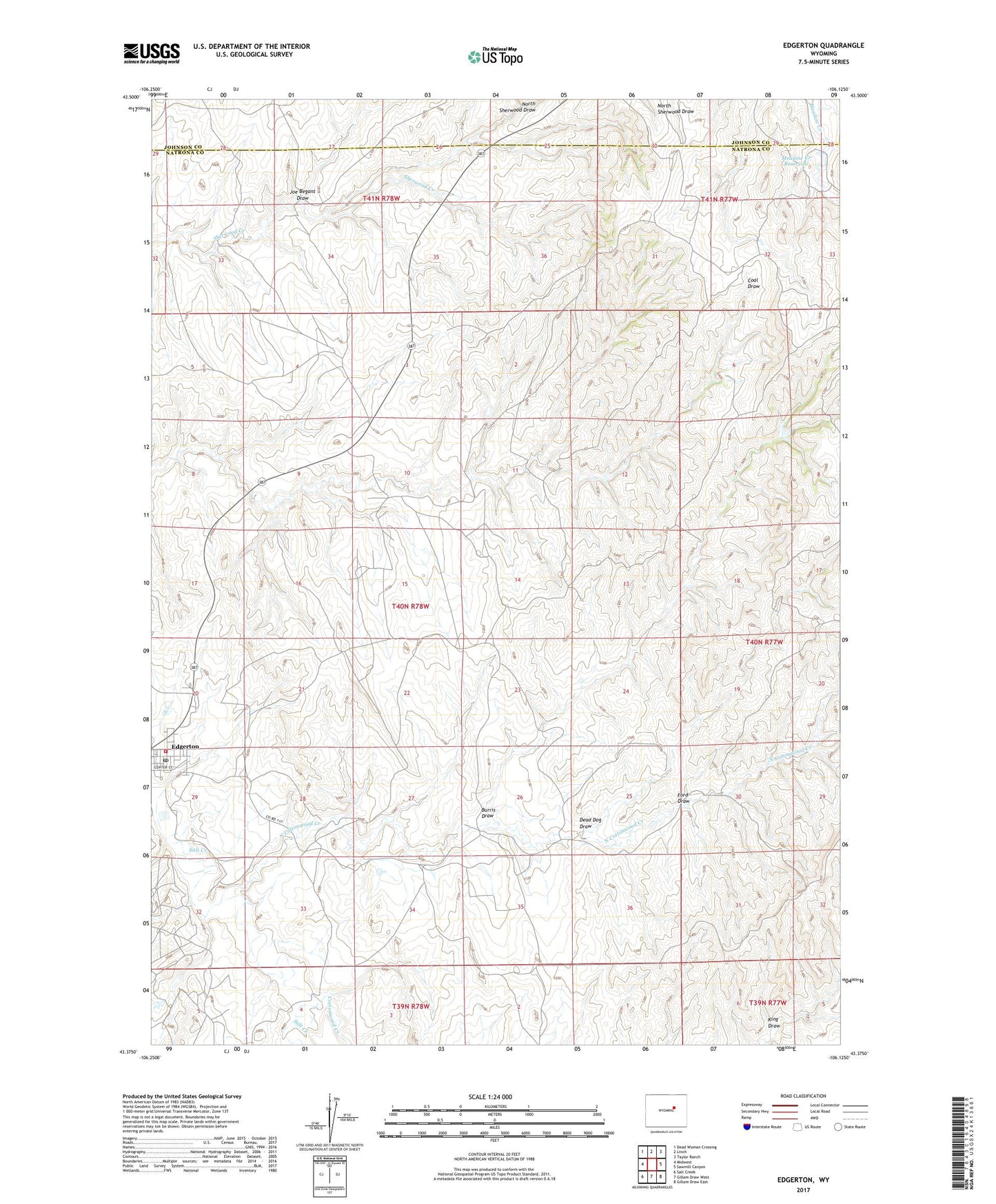
2021 topographic map quadrangle Edgerton in the state of Wyoming. Scale: 1:24000. Based on the newly updated USGS 7.5' US Topo map series, this map is in the following counties: Natrona, Johnson. The map contains contour data, water features, and other items you are used to seeing on USGS maps, but also has updated roads and other features. This is the next generation of topographic maps. Printed on high-quality waterproof paper with UV fade-resistant inks.
Quads adjacent to this one:
West: Midwest
Northwest: Dead Woman Crossing
North: Linch
Northeast: Taylor Ranch
East: Sawmill Canyon
Southeast: Gillam Draw East
South: Gillam Draw West
Southwest: Salt Creek
This map covers the same area as the classic USGS quad with code o43106d2.
Contains the following named places: Burris Draw, Cottonwood Creek, Dead Dog Draw, East Salt Creek Oil Field, Edgerton, Edgerton Emergency Services, Edgerton Post Office, Ford Draw, Joe Begant Draw, King Draw, Meadow Creek Dam, Meadow Creek Reservoir, North Cottonwood Creek, North Sherwood Draw, Parsons Ranch, Town of Edgerton, Western States Number 1 Dam, Western States Number 1 Reservoir, ZIP Code: 82635