MyTopo
Little Thunder Reservoir Wyoming US Topo Map
Couldn't load pickup availability
Also explore the Little Thunder Reservoir Forest Service Topo of this same quad for updated USFS data
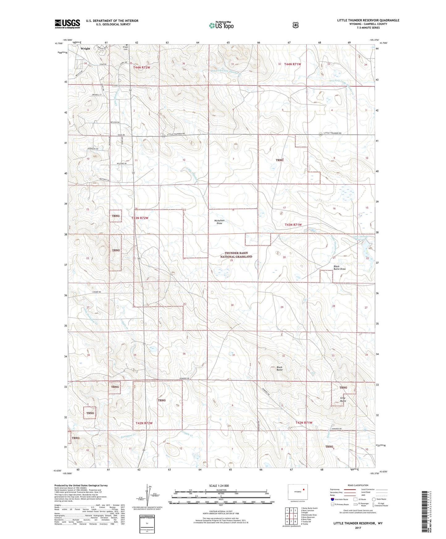
2021 topographic map quadrangle Little Thunder Reservoir in the state of Wyoming. Scale: 1:24000. Based on the newly updated USGS 7.5' US Topo map series, this map is in the following counties: Campbell. The map contains contour data, water features, and other items you are used to seeing on USGS maps, but also has updated roads and other features. This is the next generation of topographic maps. Printed on high-quality waterproof paper with UV fade-resistant inks.
Quads adjacent to this one:
West: Rattlesnake Draw
Northwest: Rocky Butte Gulch
North: Reno Junction
Northeast: Hilight
East: Reno Reservoir
Southeast: Teckla
South: Teckla SW
Southwest: Reno Flats
This map covers the same area as the classic USGS quad with code o43105f4.
Contains the following named places: Black Butte, Black Butte Draw, Cottonwood School, Dale Creek Mine, Edwards Ranch, Gray Butte, Highway School, Little Porcupine Creek, Little Thunder Reservoir, Nicholson Draw, Rochelle Lake, Saint Francis Church, Stuart Dam, Stuart Ranch, Thunder Basin Number 10 Dam, Town of Wright, Underwood Ranch, Wright, Wright Junior High School, Wright Pit, Wyoming State Maintenance Center