MyTopo
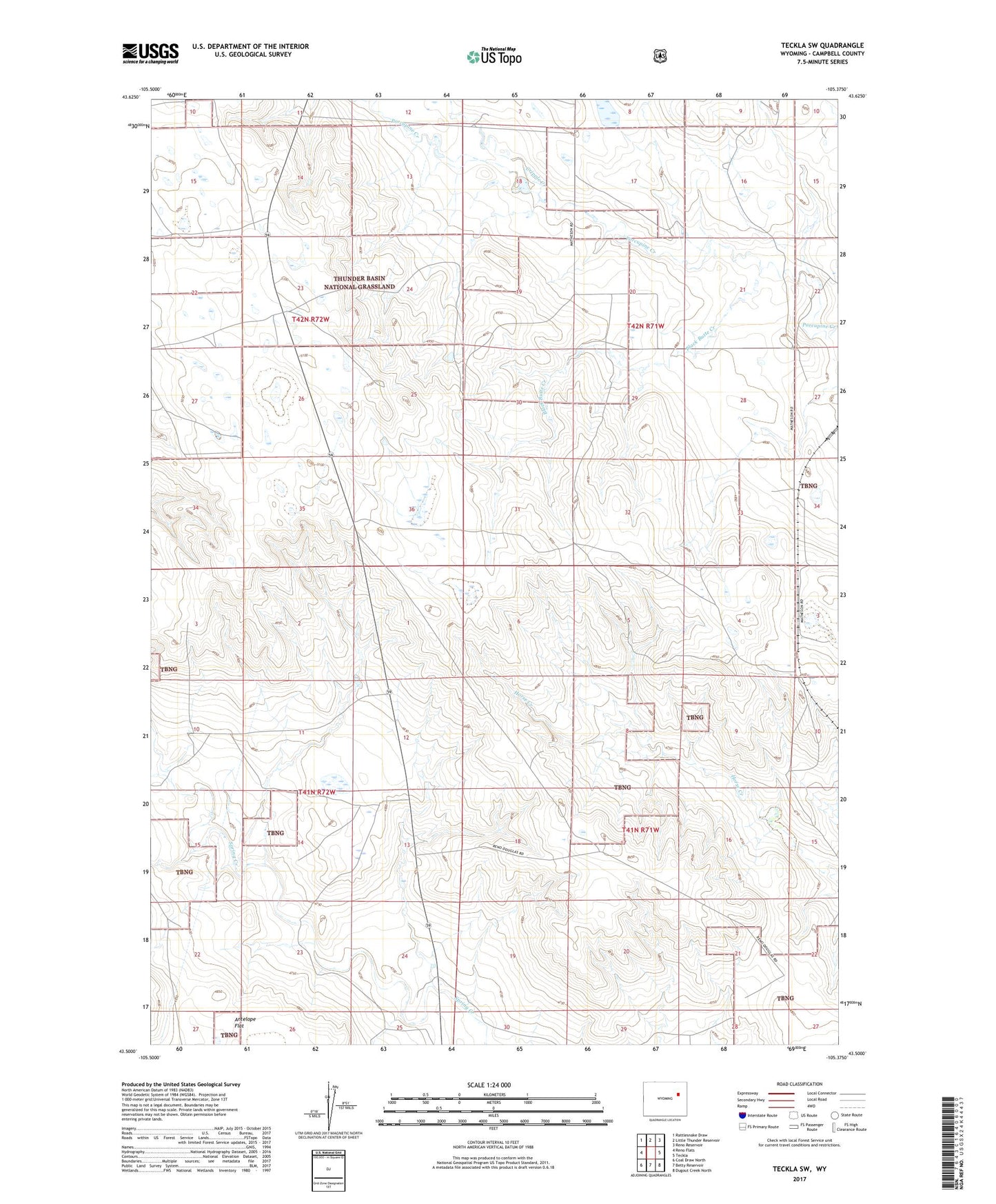
Teckla SW Wyoming US Topo Map
Couldn't load pickup availability
Also explore the Teckla SW Forest Service Topo of this same quad for updated USFS data
2021 topographic map quadrangle Teckla SW in the state of Wyoming. Scale: 1:24000. Based on the newly updated USGS 7.5' US Topo map series, this map is in the following counties: Campbell. The map contains contour data, water features, and other items you are used to seeing on USGS maps, but also has updated roads and other features. This is the next generation of topographic maps. Printed on high-quality waterproof paper with UV fade-resistant inks.
Quads adjacent to this one:
West: Reno Flats
Northwest: Rattlesnake Draw
North: Little Thunder Reservoir
Northeast: Reno Reservoir
East: Teckla
Southeast: Dugout Creek North
South: Betty Reservoir
Southwest: Coal Draw North
This map covers the same area as the classic USGS quad with code o43105e4.
Contains the following named places: Antelope Flat, Black Butte Creek, Bridle Bit Ranch, Cripple Creek, F C R Detention Dam, F C R Detention Reservoir, Potter Pit, Reno Creek Project Mine, Sioux Ranch