MyTopo
Lysite Wyoming US Topo Map
Couldn't load pickup availability
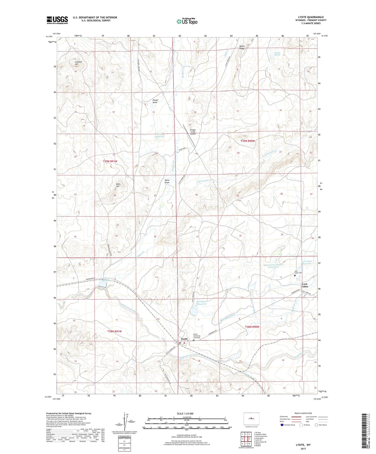
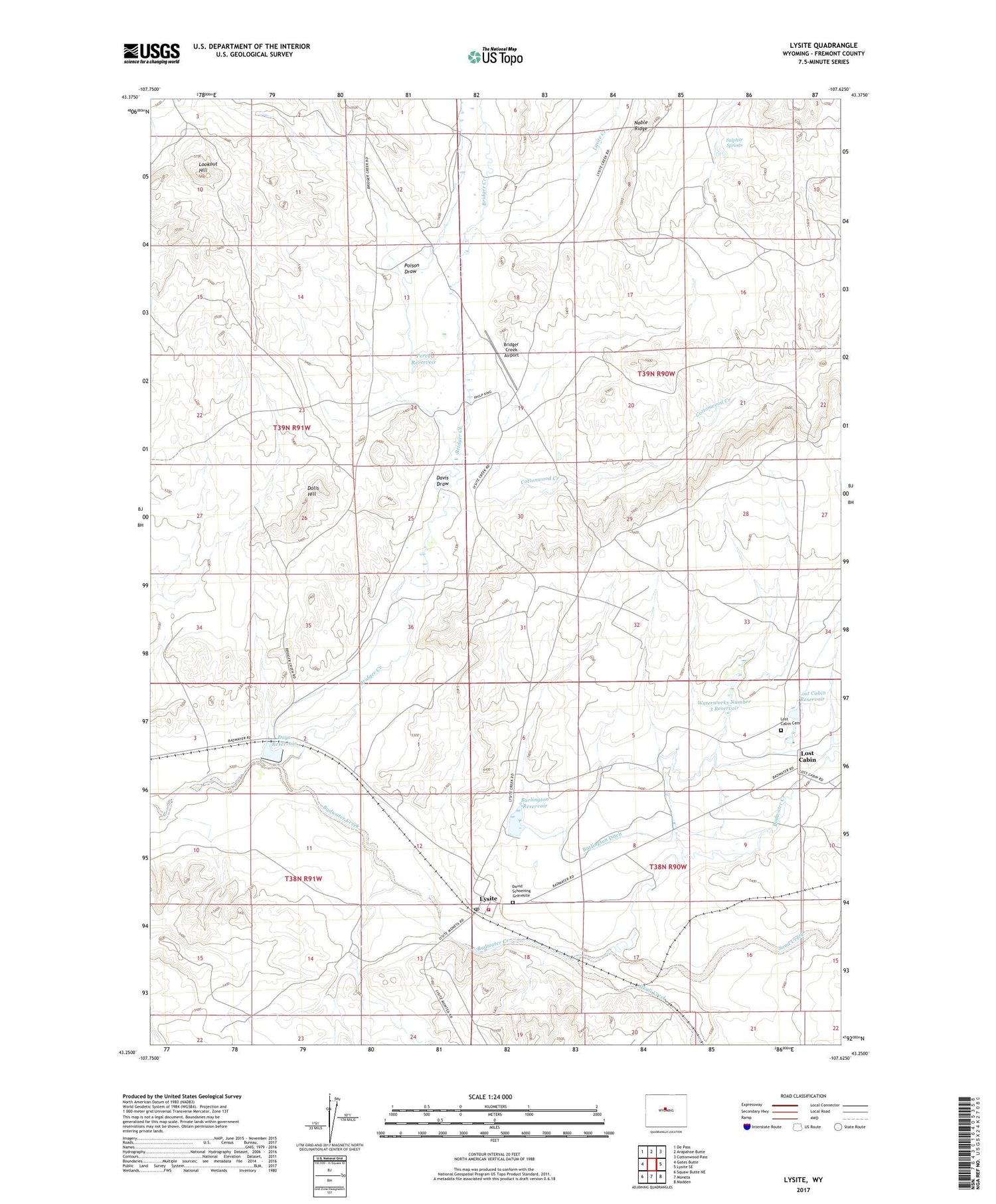
2021 topographic map quadrangle Lysite in the state of Wyoming. Scale: 1:24000. Based on the newly updated USGS 7.5' US Topo map series, this map is in the following counties: Fremont. The map contains contour data, water features, and other items you are used to seeing on USGS maps, but also has updated roads and other features. This is the next generation of topographic maps. Printed on high-quality waterproof paper with UV fade-resistant inks.
Quads adjacent to this one:
West: Gates Butte
Northwest: De Pass
North: Arapahoe Butte
Northeast: Cottonwood Pass
East: Lysite SE
Southeast: Madden
South: Moneta
Southwest: Squaw Butte NE
Contains the following named places: Alkali Creek, Battle Axe Dam, Battle Axe Reservoir, Bridger Creek, Bridger Creek Airport, Burlington Ditch, Burlington Reservoir, Burlington Reservoir Dam, Cottonwood Creek, David Schoening Gravesite, Davis Draw, Days Reservoir, Dolis Hill, Fremont County Fire Protection District Battalion 2 Lysite, Lookout Hill, Lost Cabin, Lost Cabin Airport, Lost Cabin Cemetery, Lost Cabin Reservoir, Lysite, Lysite Creek, Lysite Post Office, Noble Ridge, Percy Dam, Percy Reservoir, Poison Draw, Sand Creek, Sulphur Springs, Waterworks Number 3 Dam, Waterworks Number 3 Reservoir