MyTopo
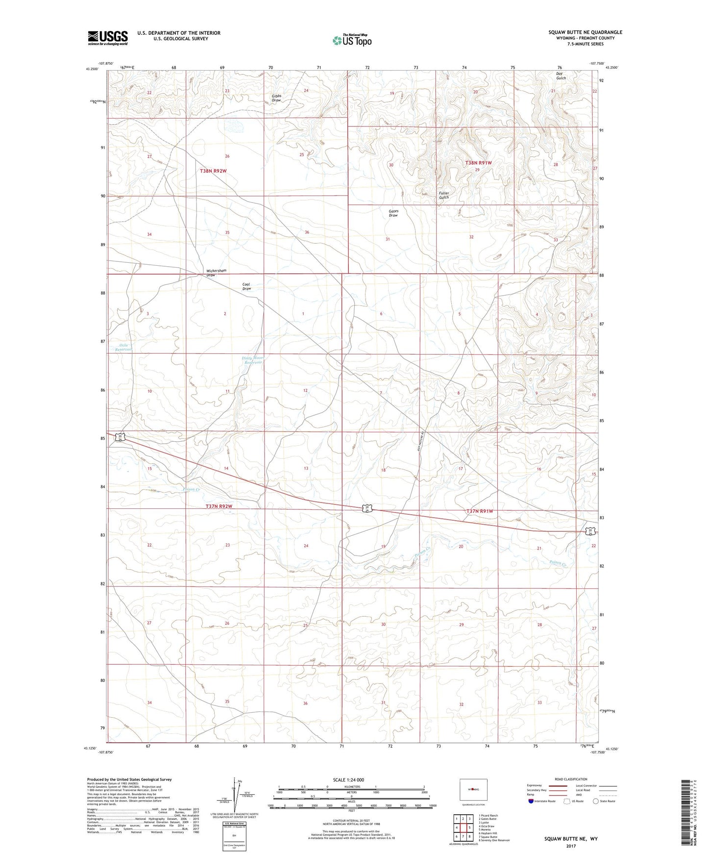
Squaw Butte NE Wyoming US Topo Map
Couldn't load pickup availability
2023 topographic map quadrangle Squaw Butte NE in the state of Wyoming. Scale: 1:24000. Based on the newly updated USGS 7.5' US Topo map series, this map is in the following counties: Fremont. The map contains contour data, water features, and other items you are used to seeing on USGS maps, but also has updated roads and other features. This is the next generation of topographic maps. Printed on high-quality waterproof paper with UV fade-resistant inks.
Quads adjacent to this one:
West: Ocla Draw
Northwest: Picard Ranch
North: Gates Butte
Northeast: Lysite
East: Moneta
Southeast: Seventy One Reservoir
South: Squaw Butte
Southwest: Haybarn Hill
This map covers the same area as the classic USGS quad with code o43107b7.
Contains the following named places: Coal Draw, Dinty Moore Reservoir, Shoshoni Division, Wickersham Draw