MyTopo
De Pass Wyoming US Topo Map
Couldn't load pickup availability
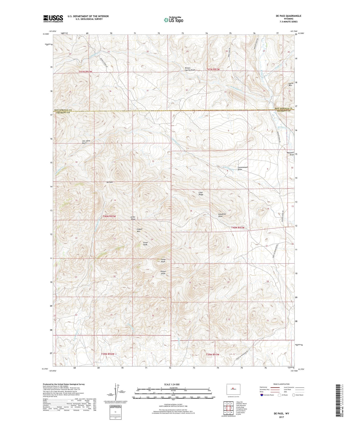
2021 topographic map quadrangle De Pass in the state of Wyoming. Scale: 1:24000. Based on the newly updated USGS 7.5' US Topo map series, this map is in the following counties: Fremont, Hot Springs. The map contains contour data, water features, and other items you are used to seeing on USGS maps, but also has updated roads and other features. This is the next generation of topographic maps. Printed on high-quality waterproof paper with UV fade-resistant inks.
Quads adjacent to this one:
West: Guffy Peak
Northwest: Blue Hill
North: Rathbun Ranch
Northeast: Bull Mountain
East: Arapahoe Butte
Southeast: Lysite
South: Gates Butte
Southwest: Picard Ranch
This map covers the same area as the classic USGS quad with code o43107d7.
Contains the following named places: Berger Ranch, Blue Feather Mine, Bray-Kile Claim, Brown Spring Draw, Canning Ranch, Cliff Number Four Mine, Cliff Number One Mine, Cottonwood Draw, Day Homestead, De Pass, De Ranch, DePass Mine, East Fork Mine, Fannie Number Four Mine, Fuller Number Two Mine, Fuller Peak, Fuller Ranch, Goedicke Draw, Goedicke Ranch, Golden Cabin, Greer Peak, Hesitation Number One Mine, Jenks Creek, Joe Johns Basin, Kermac Number One Mine, Lime Ridge, Marinville Ranch, McClain Mine, Nichols Ranch, Philp Ranch, Robeson Mine, West Bridger Creek