MyTopo
Gates Butte Wyoming US Topo Map
Couldn't load pickup availability
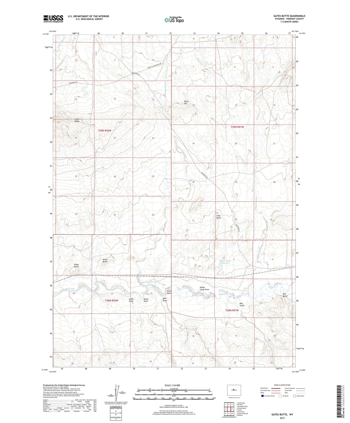
2021 topographic map quadrangle Gates Butte in the state of Wyoming. Scale: 1:24000. Based on the newly updated USGS 7.5' US Topo map series, this map is in the following counties: Fremont. The map contains contour data, water features, and other items you are used to seeing on USGS maps, but also has updated roads and other features. This is the next generation of topographic maps. Printed on high-quality waterproof paper with UV fade-resistant inks.
Quads adjacent to this one:
West: Picard Ranch
Northwest: Guffy Peak
North: De Pass
Northeast: Arapahoe Butte
East: Lysite
Southeast: Moneta
South: Squaw Butte NE
Southwest: Ocla Draw
This map covers the same area as the classic USGS quad with code o43107c7.
Contains the following named places: Baby Number One Mine, Day Butte, Day Gulch, Dolus Creek, Dolus Hill, Fuller Gulch, Gate, Gates Butte, Gates Draw, Gibbs Butte, Gibbs Draw, Gibbs Place, Long Butte, Lucky Penny Number One Mine, Rate Draw, Rate Sheep Camp, Schoening Creek, Sheep Camp Draw, Sheep Camp Reservoir