MyTopo
Seven L Creek East Wyoming US Topo Map
Couldn't load pickup availability
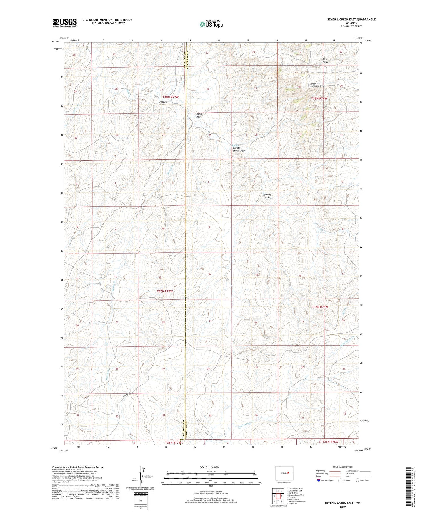
2021 topographic map quadrangle Seven L Creek East in the state of Wyoming. Scale: 1:24000. Based on the newly updated USGS 7.5' US Topo map series, this map is in the following counties: Converse, Natrona. The map contains contour data, water features, and other items you are used to seeing on USGS maps, but also has updated roads and other features. This is the next generation of topographic maps. Printed on high-quality waterproof paper with UV fade-resistant inks.
Quads adjacent to this one:
West: Seven L Creek West
Northwest: Gillam Draw West
North: Gillam Draw East
Northeast: Marsh Draw
East: Fly Draw
Southeast: Gumbo Hill
South: Beauchamp Reservoir
Southwest: McKenzie Flat
This map covers the same area as the classic USGS quad with code o43106b1.
Contains the following named places: Amerada Camp, Bobcat Creek, Coopers Draw, Coyote Smith Draw, Ormsby Draw, Seven L Creek, Seven L Ranch, Shonsy Draw