MyTopo
Meeteetse East Wyoming US Topo Map
Couldn't load pickup availability
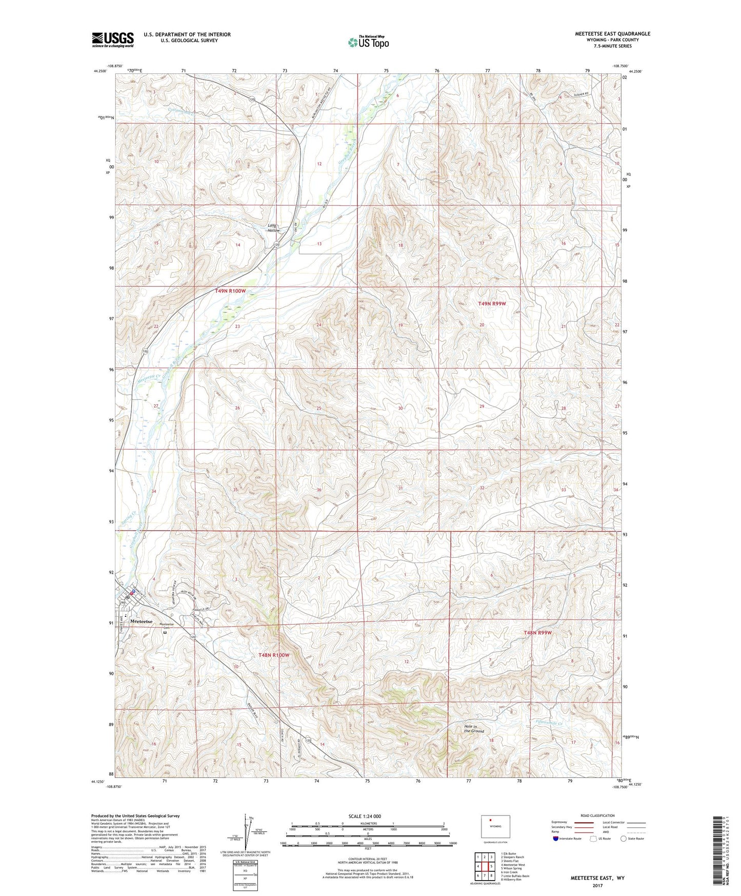
2021 topographic map quadrangle Meeteetse East in the state of Wyoming. Scale: 1:24000. Based on the newly updated USGS 7.5' US Topo map series, this map is in the following counties: Park. The map contains contour data, water features, and other items you are used to seeing on USGS maps, but also has updated roads and other features. This is the next generation of topographic maps. Printed on high-quality waterproof paper with UV fade-resistant inks.
Quads adjacent to this one:
West: Meeteetse West
Northwest: Elk Butte
North: Sleepers Ranch
Northeast: Sheets Flat
East: Wilson Spring
Southeast: Hillberry Rim
South: Little Buffalo Basin
Southwest: Iron Creek
This map covers the same area as the classic USGS quad with code o44108b7.
Contains the following named places: Barling Pit, Cottonwood Creek, Long Hollow, Meeteetse, Meeteetse Cemetery, Meeteetse Creek, Meeteetse Creek Pit, Meeteetse High School, Meeteetse Middle School, Meeteetse Post Office, Meeteetse School, Meeteetse Volunteer Fire Department, Park County Sheriff's Office - Meeteetse Station, Town of Meeteetse