
MyTopo
Millbrook Wyoming US Topo Map
Couldn't load pickup availability
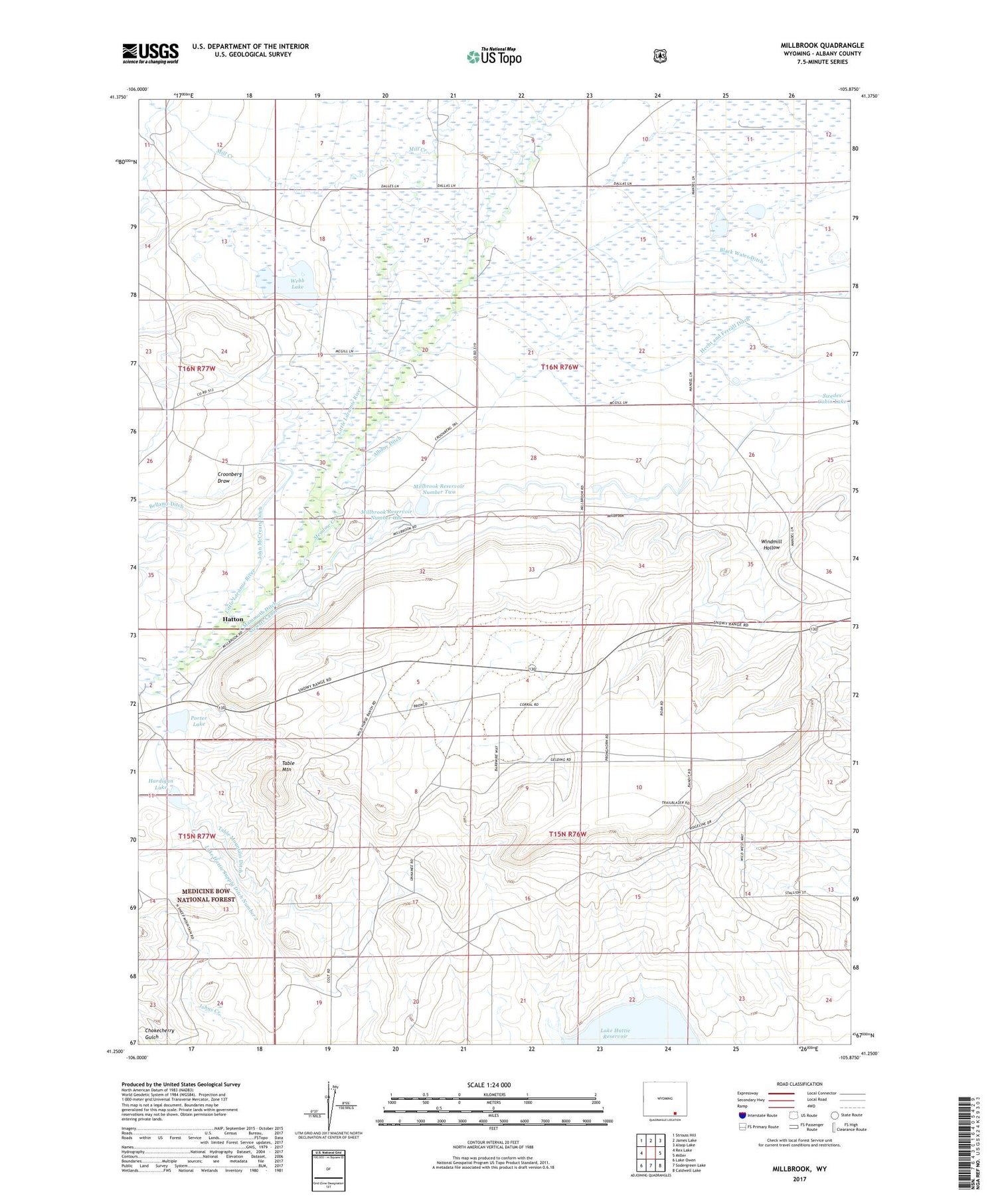
2021 topographic map quadrangle Millbrook in the state of Wyoming. Scale: 1:24000. Based on the newly updated USGS 7.5' US Topo map series, this map is in the following counties: Albany. The map contains contour data, water features, and other items you are used to seeing on USGS maps, but also has updated roads and other features. This is the next generation of topographic maps. Printed on high-quality waterproof paper with UV fade-resistant inks.
Quads adjacent to this one:
West: Rex Lake
Northwest: Strouss Hill
North: James Lake
Northeast: Alsop Lake
East: Miller
Southeast: Caldwell Lake
South: Sodergreen Lake
Southwest: Lake Owen
Contains the following named places: Albany Ditch, Black Water Ditch, Croonberg Draw, Croonberg Ranch, Dalles Ranch, Dry Creek, Forbes Ranch, Hardigan Lake, Harran Ditch, Hatton, Hecht and Ferrall Ditch, John McCreary Ditch, Lake Hattie Supply Ditch Number 2, Loban Ranch, Mammoth Ditch, Markley Ranch, McCue Ranch, McGill Ranch, Meadow Creek, Millbrook, Millbrook Number 2 Dam, Millbrook Reservoir Number One, Millbrook Reservoir Number Two, Millbrook School, Olson Ranch, Porter Lake, Stewart Canal, Symes and Deerlove Ditch, Table Mountain, Table Mountain Ditch, Webb Lake, Whitney Ranch, Windmill Hollow


