MyTopo
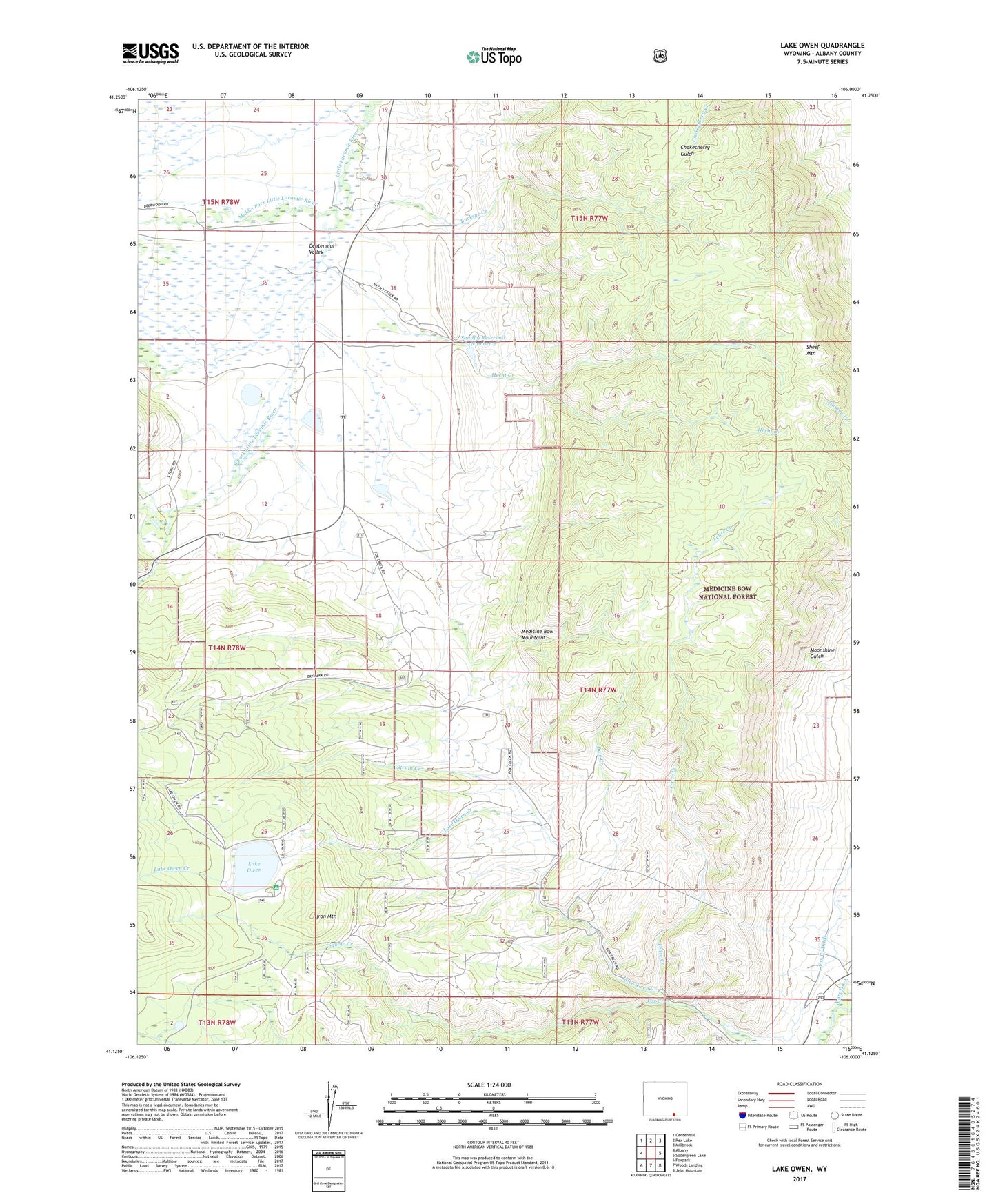
Lake Owen Wyoming US Topo Map
Couldn't load pickup availability
Also explore the Lake Owen Forest Service Topo of this same quad for updated USFS data
2023 topographic map quadrangle Lake Owen in the state of Wyoming. Scale: 1:24000. Based on the newly updated USGS 7.5' US Topo map series, this map is in the following counties: Albany. The map contains contour data, water features, and other items you are used to seeing on USGS maps, but also has updated roads and other features. This is the next generation of topographic maps. Printed on high-quality waterproof paper with UV fade-resistant inks.
Quads adjacent to this one:
West: Albany
Northwest: Centennial
North: Rex Lake
Northeast: Millbrook
East: Sodergreen Lake
Southeast: Jelm Mountain
South: Woods Landing
Southwest: Foxpark
This map covers the same area as the classic USGS quad with code o41106b1.
Contains the following named places: Buckeye Creek, Buckeye School, Dale Creek, Fence Creek, Fox Creek Ditch, Hecht Creek, Iron Mountain, Lake, Lake Owen, Lake Owen Campground, Lake Owen Creek, Lake Owen Dam, Lake Owen Mafic Complex Mine, Middle Fork Little Laramie River, Mountain Meadow Ranch, South Fork Little Laramie River, Squaw Creek, Strain Creek, Sunby Reservoir, Sundby Dam, Sundby Reservoir Number 2, Sundby Reservoir Number 2 Dam