MyTopo
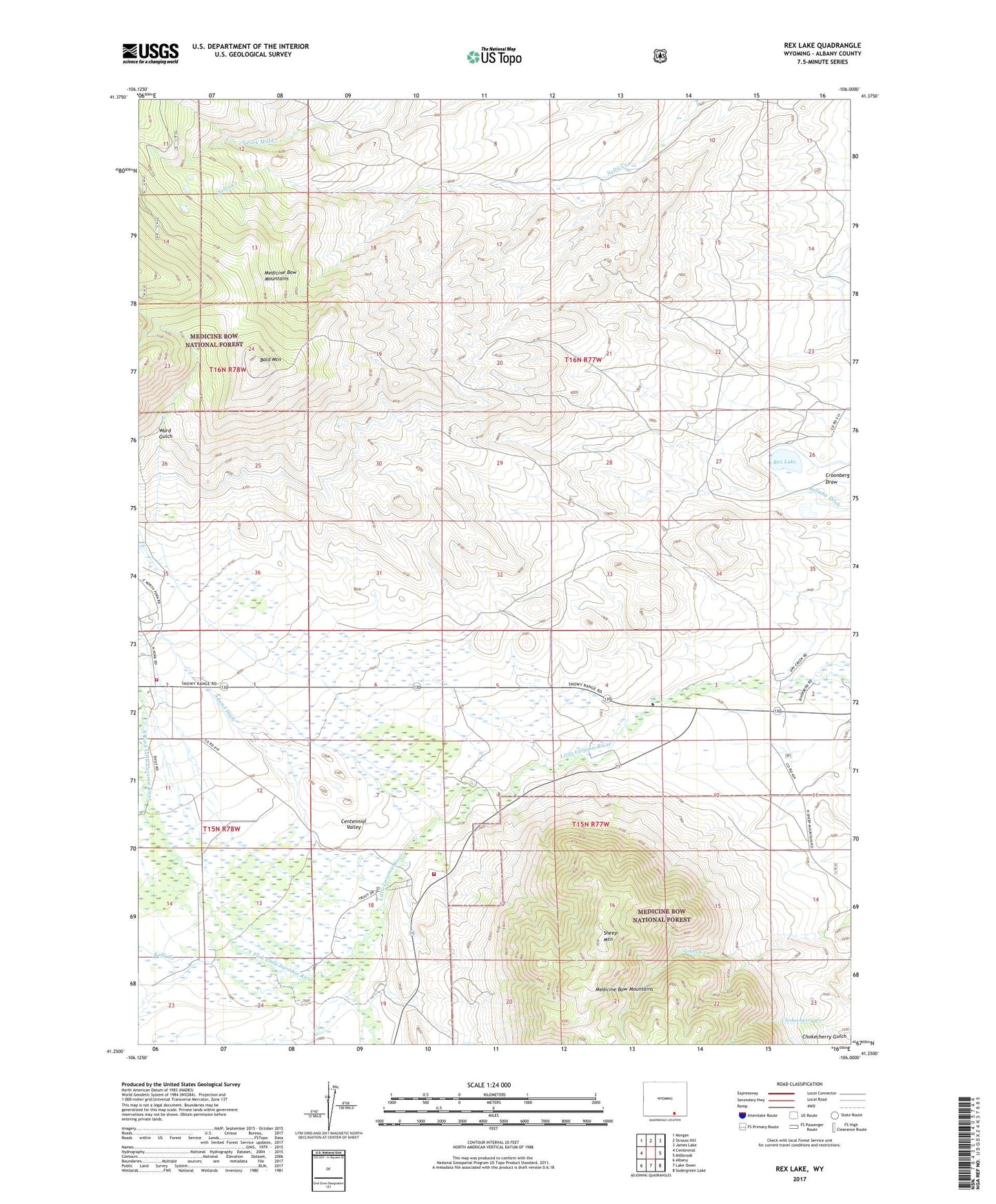
Rex Lake Wyoming US Topo Map
Couldn't load pickup availability
Also explore the Rex Lake Forest Service Topo of this same quad for updated USFS data
2021 topographic map quadrangle Rex Lake in the state of Wyoming. Scale: 1:24000. Based on the newly updated USGS 7.5' US Topo map series, this map is in the following counties: Albany. The map contains contour data, water features, and other items you are used to seeing on USGS maps, but also has updated roads and other features. This is the next generation of topographic maps. Printed on high-quality waterproof paper with UV fade-resistant inks.
Quads adjacent to this one:
West: Centennial
Northwest: Morgan
North: Strouss Hill
Northeast: James Lake
East: Millbrook
Southeast: Sodergreen Lake
South: Lake Owen
Southwest: Albany
This map covers the same area as the classic USGS quad with code o41106c1.
Contains the following named places: Bald Mountain, Bellamy Ditch, Centennial Valley, Centennial Valley Volunteer Fire Department, Centennial Valley Volunteer Fire Department - Main Station, Crescent Lode Number One, Kelly Creek, North Fork Ditch Number 2, North Fork Little Laramie River, Rex Lake, Rex Lake Oil Field, Sheep Mountain Mine, Sunshine Mine, Ward Gulch