MyTopo
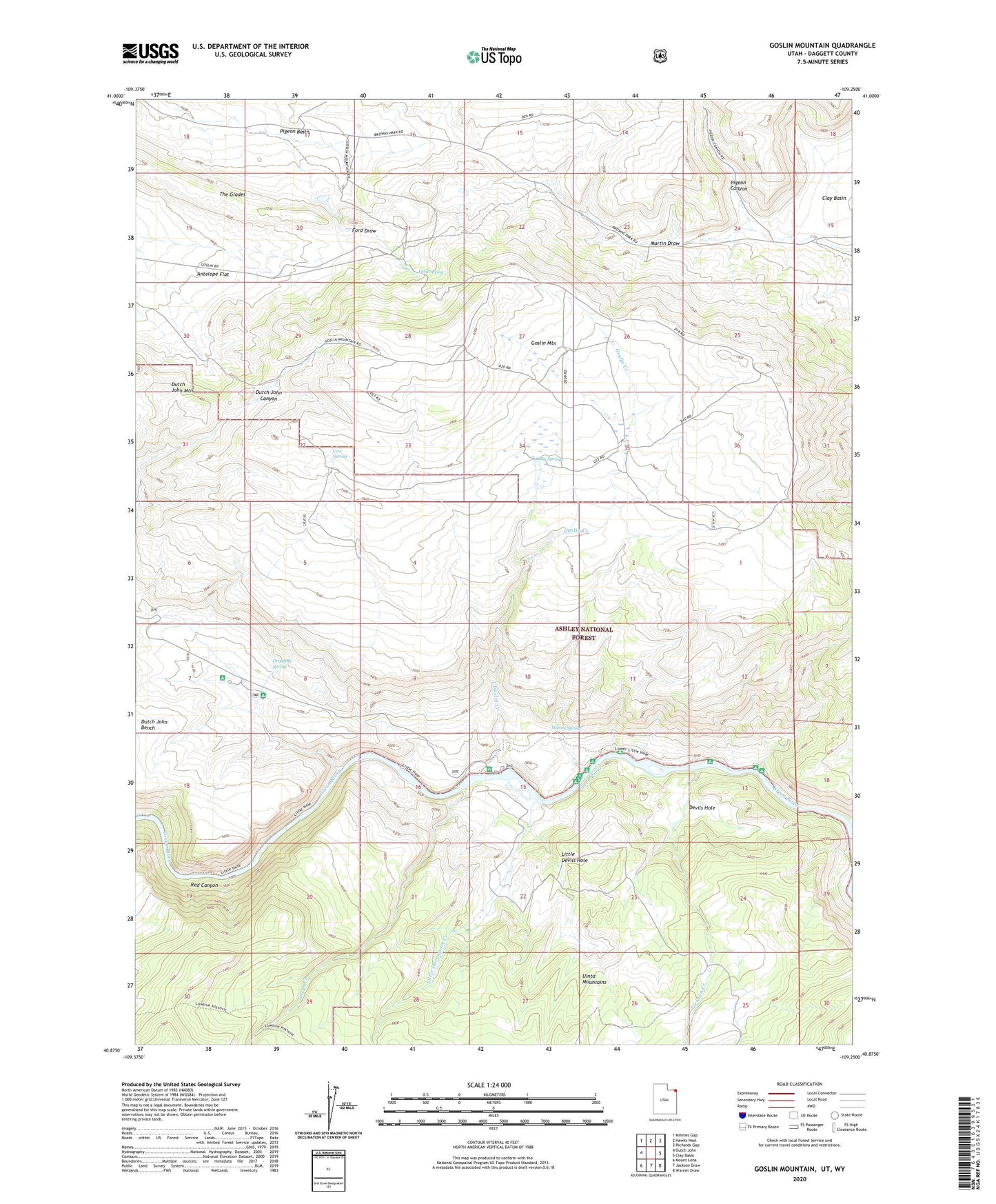
Goslin Mountain Utah US Topo Map
Couldn't load pickup availability
Also explore the Goslin Mountain Forest Service Topo of this same quad for updated USFS data
2023 topographic map quadrangle Goslin Mountain in the state of Utah. Scale: 1:24000. Based on the newly updated USGS 7.5' US Topo map series, this map is in the following counties: Daggett, Sweetwater. The map contains contour data, water features, and other items you are used to seeing on USGS maps, but also has updated roads and other features. This is the next generation of topographic maps. Printed on high-quality waterproof paper with UV fade-resistant inks.
Quads adjacent to this one:
West: Dutch John
Northwest: Minnies Gap
North: Hawks Nest
Northeast: Richards Gap
East: Clay Basin
Southeast: Warren Draw
South: Jackson Draw
Southwest: Mount Lena
This map covers the same area as the classic USGS quad with code o40109h3.
Contains the following named places: Big Cottonwood Camp, Big Pine Camp, Big Springs, Cow Spring, Devils Hole, Devils Hole Camp, Dripping Spring, Dripping Spring Campground, Edith Aspden Park, Ford Draw, Ford Spring, Gonge Creek Camp, Gorge Creek, Goslin Creek, Goslin Mountain, Goslin Mountain Wildlife Management Area, Jackson Camp, Jackson Creek, Little Davenport Creek, Little Davenport Wildlife Management Area, Little Devils Hole, Little Hole Wildlife Management Area, Little Hotel Campground, Manns Spring, Pigeon Basin, Pigeon Canyon, Pugmire Pocket Campground, Red Canyon, Red Creek, Red Creek Campground, Trails End Camp, Uinta Mountains