MyTopo
Gaff Creek Wyoming US Topo Map
Couldn't load pickup availability
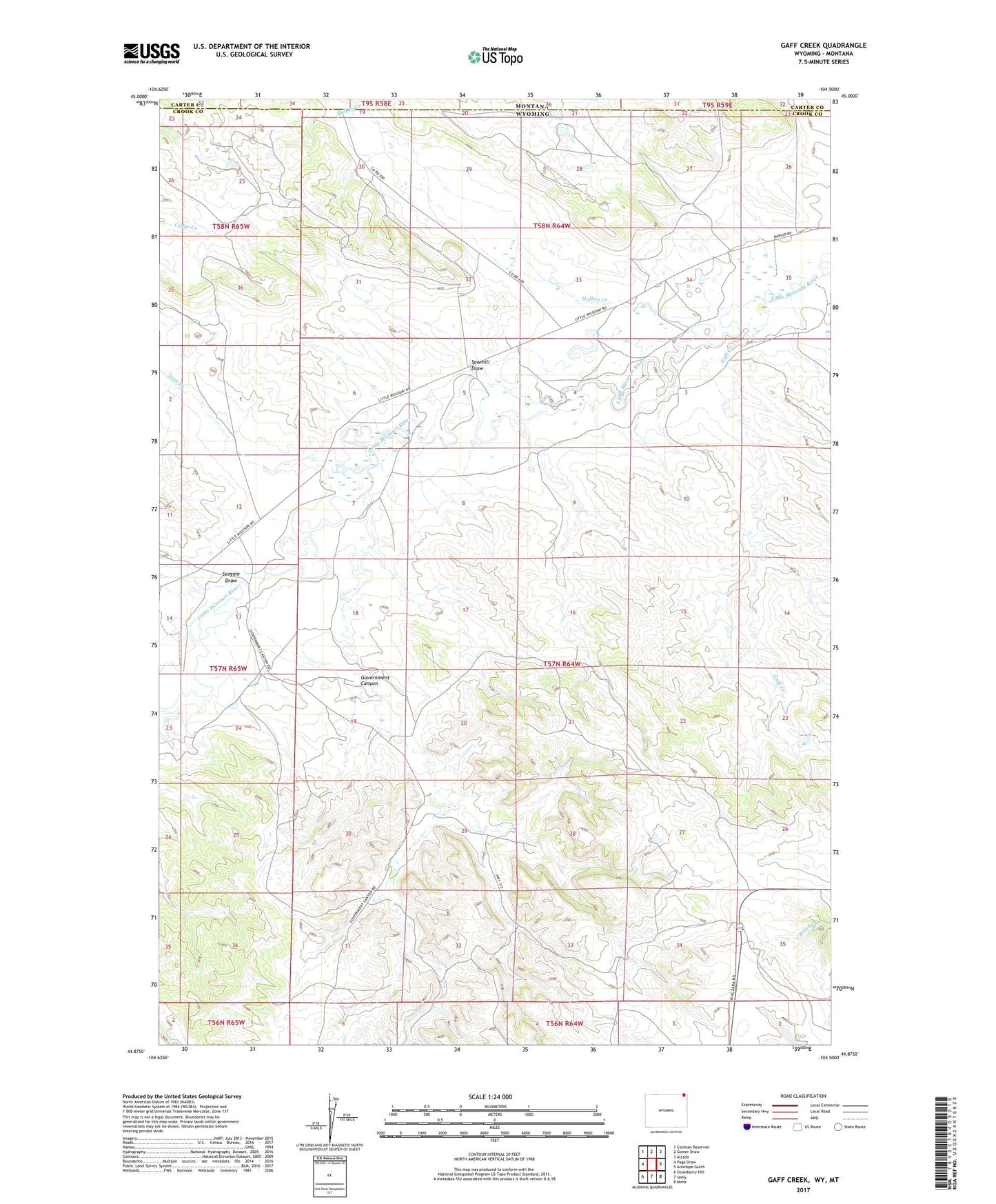
2021 topographic map quadrangle Gaff Creek in the states of Wyoming, Montana. Scale: 1:24000. Based on the newly updated USGS 7.5' US Topo map series, this map is in the following counties: Crook, Carter. The map contains contour data, water features, and other items you are used to seeing on USGS maps, but also has updated roads and other features. This is the next generation of topographic maps. Printed on high-quality waterproof paper with UV fade-resistant inks.
Quads adjacent to this one:
West: Page Draw
Northwest: Cochran Reservoir
North: Gomer Draw
Northeast: Alzada
East: Antelope Gulch
Southeast: Mona
South: Seely
Southwest: Strawberry Hill
This map covers the same area as the classic USGS quad with code o44104h5.
Contains the following named places: A58-36-3 Mine, Alzada Mini-Mutes Radar Site, B58-34-2, Foster Ranch, Gaff Creek, Government Canyon, Government Canyon School, H L Dam, H L Reservoir, Harney Ranch, Holben Creek, Lobban Ranch, Sage Creek, Sawmill Draw, Scoggin Draw, Scoggin Ranch, Virginia Sixteen Mine, Whitney Ranch