MyTopo
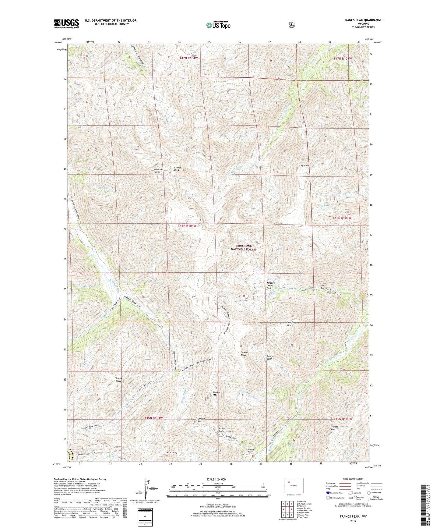
Francs Peak Wyoming US Topo Map
Couldn't load pickup availability
Also explore the Francs Peak Forest Service Topo of this same quad for updated USFS data
2021 topographic map quadrangle Francs Peak in the state of Wyoming. Scale: 1:24000. Based on the newly updated USGS 7.5' US Topo map series, this map is in the following counties: Park, Fremont. The map contains contour data, water features, and other items you are used to seeing on USGS maps, but also has updated roads and other features. This is the next generation of topographic maps. Printed on high-quality waterproof paper with UV fade-resistant inks.
Quads adjacent to this one:
West: Mount Burwell
Northwest: Irish Rock
North: Phelps Mountain
Northeast: Pitchfork
East: Dick Creek Lakes
Southeast: Twin Peaks
South: Dunrud Peak
Southwest: Wiggins Peak
This map covers the same area as the classic USGS quad with code o43109h3.
Contains the following named places: Absaroka Range, Anaconda Mine, Brown Basin, Brown Mountain, Calf Creek, Canyon Creek, Chief Mountain, Dundee Mountain, Francs Peak, Galena Basin, Galena Creek, Galena Ridge, Gold Reef Mining Region, Gold Reef Tunnel, Golden Ridge Tunnel, Greybull Pass, Greybull River Trail, Iowa Mine, Jojo Lake, Jojo Mountain, Kirwin, Kirwin Copper Mine, Kirwin Post Office, Little Johnnie Mine, Longhorn Mine, Manilla Mine, Mattice Tunnel, Meadow Creek Basin, Mendota Mine, Molly Logan Mine, Mount Crosby, Oregon Mine, Pyramid Creek, Spar Creek, Steer Creek, Yellow Creek, Yellow Ridge