MyTopo
Muddy Gap Wyoming US Topo Map
Couldn't load pickup availability
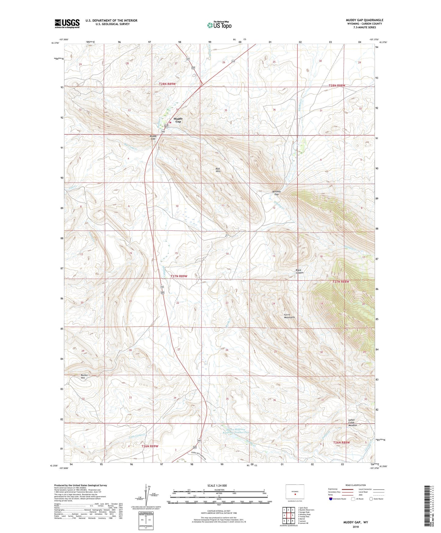
2021 topographic map quadrangle Muddy Gap in the state of Wyoming. Scale: 1:24000. Based on the newly updated USGS 7.5' US Topo map series, this map is in the following counties: Carbon. The map contains contour data, water features, and other items you are used to seeing on USGS maps, but also has updated roads and other features. This is the next generation of topographic maps. Printed on high-quality waterproof paper with UV fade-resistant inks.
Quads adjacent to this one:
West: Whiskey Peak
Northwest: Split Rock
North: Bucklin Reservoirs
Northeast: Savage Peak
East: Youngs Pass
Southeast: Lamont NE
South: Lamont
Southwest: Bairoil
This map covers the same area as the classic USGS quad with code o42107c4.
Contains the following named places: Big Camp Creek, Black Canyon, Brady Creek, Bunker Hill, Carbon County Fire Department Muddy Gap, Coal Creek, Corral Creek, Ferris Mountains Mine, George Tully Homestead, Hanna Mahoney Reservoir Number Two, Hannah Mahoney Number 1 Dam, Hannah Mahoney Number 1 Reservoir, Hannah Mahoney Number 2 Dam, Indian Creek, Indian Creek Meadow, Jennie Claim Number One Mine, Little Camp Creek, Muddy Gap, Muddy Gap Junction, Murphree Creek, Sharp 47 Ranch, Three Forks, Whiskey Gap