MyTopo
Whiskey Peak Wyoming US Topo Map
Couldn't load pickup availability
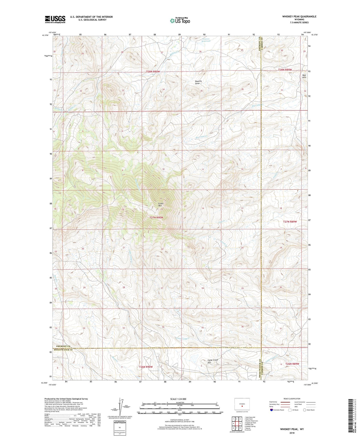
2021 topographic map quadrangle Whiskey Peak in the state of Wyoming. Scale: 1:24000. Based on the newly updated USGS 7.5' US Topo map series, this map is in the following counties: Fremont, Carbon, Sweetwater. The map contains contour data, water features, and other items you are used to seeing on USGS maps, but also has updated roads and other features. This is the next generation of topographic maps. Printed on high-quality waterproof paper with UV fade-resistant inks.
Quads adjacent to this one:
West: Sagebrush Park
Northwest: Split Rock NW
North: Split Rock
Northeast: Bucklin Reservoirs
East: Muddy Gap
Southeast: Lamont
South: Bairoil
Southwest: Hadsell Spring
This map covers the same area as the classic USGS quad with code o42107c5.
Contains the following named places: Bebe Claims, Camp Creek Hill, Camp Creek Reservoir, Coors Claims, County Line Claims, Diamond Hook Ranch, GR Claims, Green Mountain, Grieves Dam, Grieves Reservoir, Joe Wimmer Homestead, Lucky Thirteen Mine, Muddy Gap Mine, Rabbit Creek, Red Hills, Tilly Homestead