MyTopo
Munger Mountain Wyoming US Topo Map
Couldn't load pickup availability
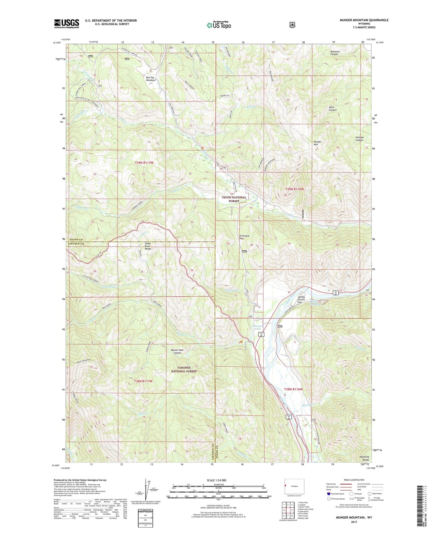
2021 topographic map quadrangle Munger Mountain in the state of Wyoming. Scale: 1:24000. Based on the newly updated USGS 7.5' US Topo map series, this map is in the following counties: Teton, Lincoln. The map contains contour data, water features, and other items you are used to seeing on USGS maps, but also has updated roads and other features. This is the next generation of topographic maps. Printed on high-quality waterproof paper with UV fade-resistant inks.
Quads adjacent to this one:
West: Observation Peak
Northwest: Teton Pass
North: Jackson
Northeast: Cache Creek
East: Camp Davis
Southeast: Bailey Lake
South: Pine Creek
Southwest: Ferry Peak
Contains the following named places: Astoria Minerial Hot Springs, Beaver Dam Canyon, Bohnetts Canyon, Bureau of Public Roads Camp, Cabin Creek Campground, Coburn Creek, Dog Creek, Hoback, Johnny Counts Flat, Little Dog Creek, Munger Mountain, North Fork Fall Creek, Pritchard Creek, Pritchard Pass, Pritchard Pond, Pup Creek, Red Top Meadows, Rock Creek, Sawpit Creek, South Cabin Creek, South Fork Fall Creek, Wolf Mountain