MyTopo
Negro Butte Wyoming US Topo Map
Couldn't load pickup availability
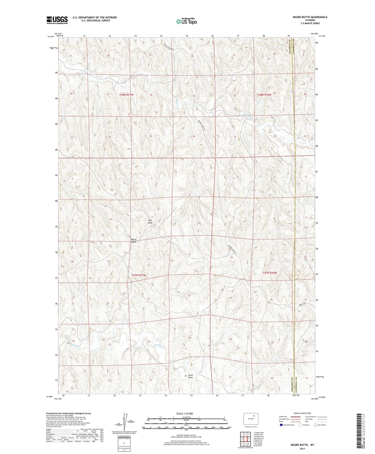
2021 topographic map quadrangle Negro Butte in the state of Wyoming. Scale: 1:24000. Based on the newly updated USGS 7.5' US Topo map series, this map is in the following counties: Johnson, Campbell. The map contains contour data, water features, and other items you are used to seeing on USGS maps, but also has updated roads and other features. This is the next generation of topographic maps. Printed on high-quality waterproof paper with UV fade-resistant inks.
Quads adjacent to this one:
West: Bowman Flat
Northwest: Juniper Draw
North: Laskie Draw
Northeast: Morgan Draw
East: Bogie Draw
Southeast: Fats Draw
South: The Nipple
Southwest: Hoe Ranch
Contains the following named places: Beaver Creek Ranch, Hood Draw, Negro Butte, Parker Well, School Section Well, Staley Well