MyTopo
Raspberry Ridge Wyoming US Topo Map
Couldn't load pickup availability
Also explore the Raspberry Ridge Forest Service Topo of this same quad for updated USFS data
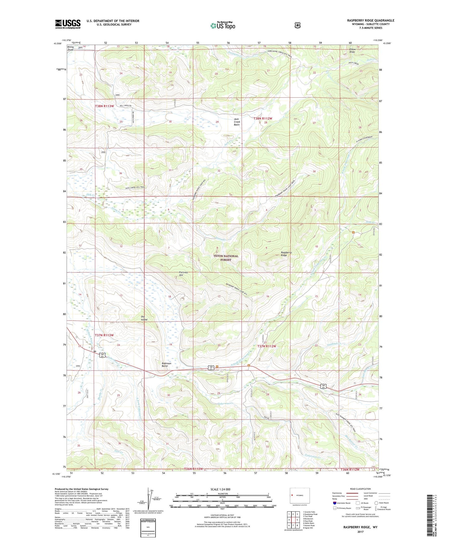
2021 topographic map quadrangle Raspberry Ridge in the state of Wyoming. Scale: 1:24000. Based on the newly updated USGS 7.5' US Topo map series, this map is in the following counties: Sublette. The map contains contour data, water features, and other items you are used to seeing on USGS maps, but also has updated roads and other features. This is the next generation of topographic maps. Printed on high-quality waterproof paper with UV fade-resistant inks.
Quads adjacent to this one:
West: Bondurant
Northwest: Granite Falls
North: Doubletop Peak
Northeast: Tosi Peak
East: Pass Peak
Southeast: Signal Hill
South: Kismet Peak
Southwest: Noble Basin
This map covers the same area as the classic USGS quad with code o43110b3.
Contains the following named places: Blackrock Ranger District, Bondurant Post Office, Dry Island, Elbow Draw, Fisherman Creek, Fisherman Pit Mine, Fortress Hill, Jack Creek Basin, Jenny Creek, Mill Creek, Muddy Creek, North Fork Fisherman Creek, Raspberry Ridge, Riling Draw, Robinson Butte, Sandrock Creek, Sled Runner Creek, Slide Creek, Sour Moose Creek, South Fork Fisherman Creek, Stub Creek