MyTopo
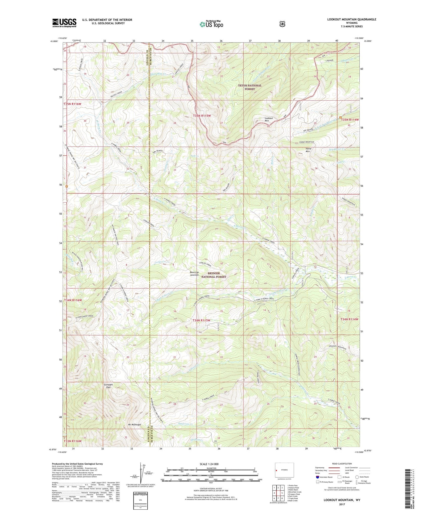
Lookout Mountain Wyoming US Topo Map
Couldn't load pickup availability
Also explore the Lookout Mountain Forest Service Topo of this same quad for updated USFS data
2021 topographic map quadrangle Lookout Mountain in the state of Wyoming. Scale: 1:24000. Based on the newly updated USGS 7.5' US Topo map series, this map is in the following counties: Sublette, Lincoln. The map contains contour data, water features, and other items you are used to seeing on USGS maps, but also has updated roads and other features. This is the next generation of topographic maps. Printed on high-quality waterproof paper with UV fade-resistant inks.
Quads adjacent to this one:
West: Blind Bull Creek
Northwest: Pickle Pass
North: Hoback Peak
Northeast: Noble Basin
East: Prospect Peak
Southeast: Maki Creek
South: Triple Peak
Southwest: Park Creek
This map covers the same area as the classic USGS quad with code o42110h5.
Contains the following named places: Beartrap Junction, Chair Creek, Corlos Creek, County Creek, Dead Cow Creek, Gunsight Pass, Horse Creek Mine, Horse Mountain, Lookout Mountain, Meridional Valley, Mule Creek, Park Creek, Rowdy Creek, Silver Mine Creek, South Fork North Horse Creek