
MyTopo
O T O Ranch Wyoming US Topo Map
Couldn't load pickup availability
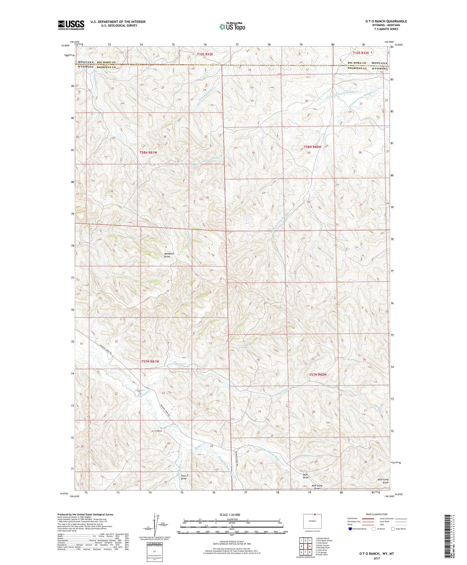
2021 topographic map quadrangle O T O Ranch in the state of Wyoming. Scale: 1:24000. Based on the newly updated USGS 7.5' US Topo map series, this map is in the following counties: Sheridan, Big Horn. The map contains contour data, water features, and other items you are used to seeing on USGS maps, but also has updated roads and other features. This is the next generation of topographic maps. Printed on high-quality waterproof paper with UV fade-resistant inks.
Quads adjacent to this one:
West: Cedar Canyon
Northwest: Holmes Ranch
North: Pine Butte School
Northeast: Forks Ranch
East: Roundup Draw
Southeast: Shuler Draw
South: S R Springs
Southwest: Jones Draw
Contains the following named places: Fordyce Deer Creek Dam, Fordyce Deer Creek Reservoir, Four X Draw, Lotspeich Prong Waddle Creek, Middle Fork Badger Creek, Mile Draw, Parker Prong Badger Creek, Seventy-seven Ranch, South Fork Badger Creek, Spring Creek


