MyTopo
Pats Bottom Wyoming US Topo Map
Couldn't load pickup availability
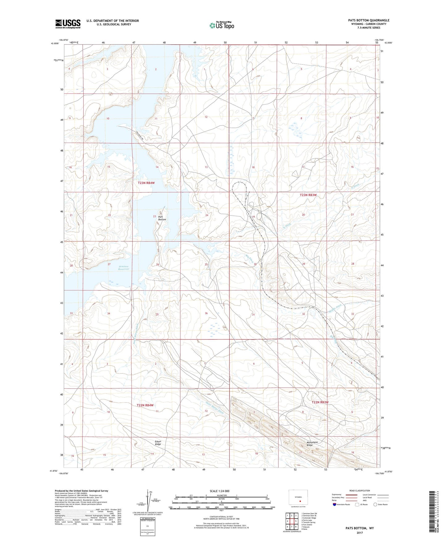
2021 topographic map quadrangle Pats Bottom in the state of Wyoming. Scale: 1:24000. Based on the newly updated USGS 7.5' US Topo map series, this map is in the following counties: Carbon. The map contains contour data, water features, and other items you are used to seeing on USGS maps, but also has updated roads and other features. This is the next generation of topographic maps. Printed on high-quality waterproof paper with UV fade-resistant inks.
Quads adjacent to this one:
West: Ferris Lake
Northwest: Seminoe Dam SW
North: Seminoe Dam SE
Northeast: Schneider Ridge
East: Tenmile Spring
Southeast: Dana
South: Walcott
Southwest: Fort Steele
This map covers the same area as the classic USGS quad with code o41106h7.
Contains the following named places: Big Ditch, Crane Mine, Dry Ditch, Medicine Bow Coal Company Mine, Medicine Bow Strip Mine, Middle Ditch, Monument Ridge, North Ditch, Pats Bottom, Saint Marys Ditch, Steel Granary Reservoir