MyTopo
Seminoe Dam SE Wyoming US Topo Map
Couldn't load pickup availability
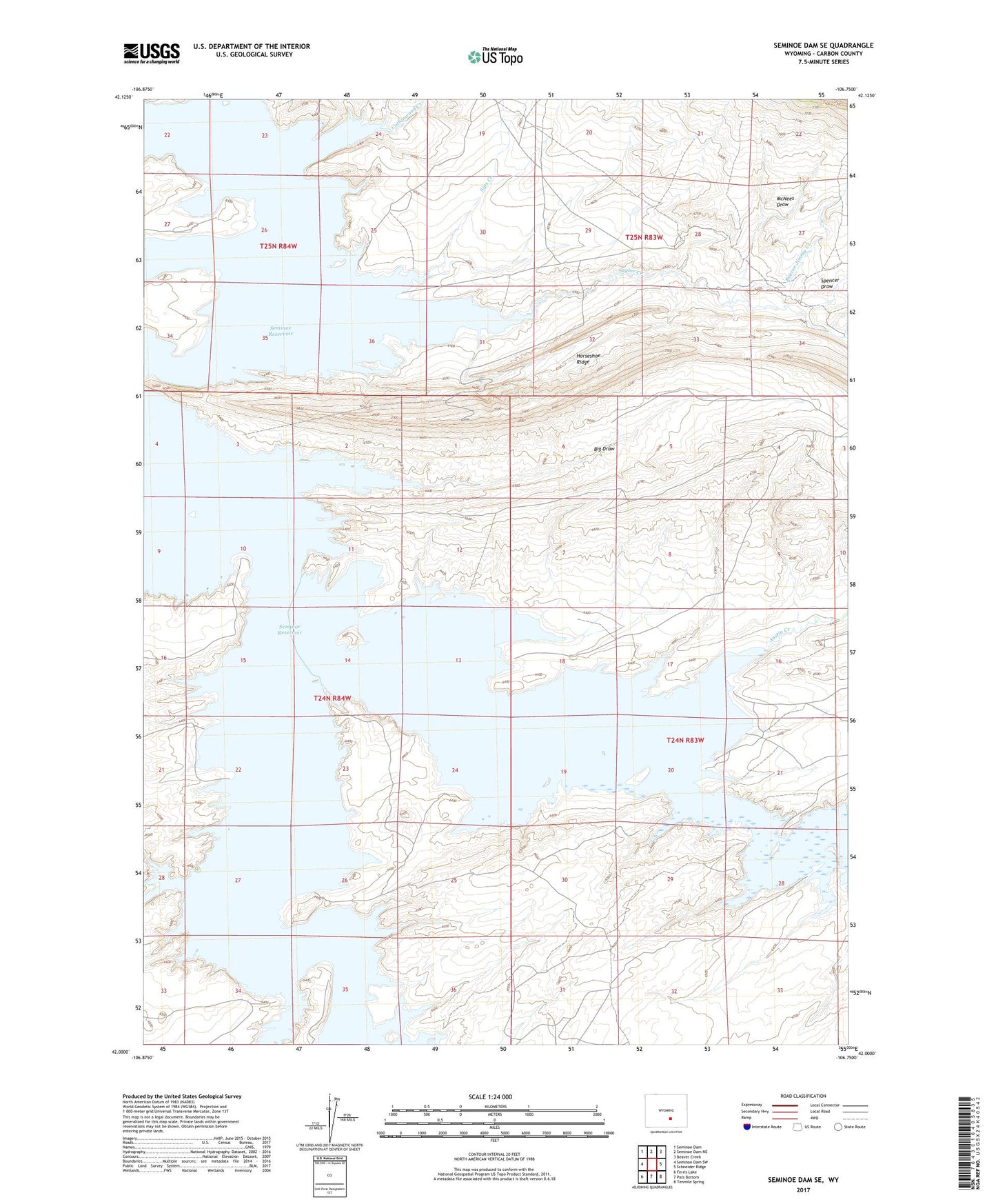
2021 topographic map quadrangle Seminoe Dam SE in the state of Wyoming. Scale: 1:24000. Based on the newly updated USGS 7.5' US Topo map series, this map is in the following counties: Carbon. The map contains contour data, water features, and other items you are used to seeing on USGS maps, but also has updated roads and other features. This is the next generation of topographic maps. Printed on high-quality waterproof paper with UV fade-resistant inks.
Quads adjacent to this one:
West: Seminoe Dam SW
Northwest: Seminoe Dam
North: Seminoe Dam NE
Northeast: Beaver Creek
East: Schneider Ridge
Southeast: Tenmile Spring
South: Pats Bottom
Southwest: Ferris Lake
This map covers the same area as the classic USGS quad with code o42106a7.
Contains the following named places: Austin Creek, Beaver Jimmy Creek, Big Draw, Cottonwood Creek, Dry Reservoir, Homestake Draw, Horseshoe Ridge, McNees Draw, McNees Ranch, Red Reservoir, Saylor Creek, Seminoe Reservoir, Sips Creek, Spencer Draw, Tennant Ranch