MyTopo
Schneider Ridge Wyoming US Topo Map
Couldn't load pickup availability
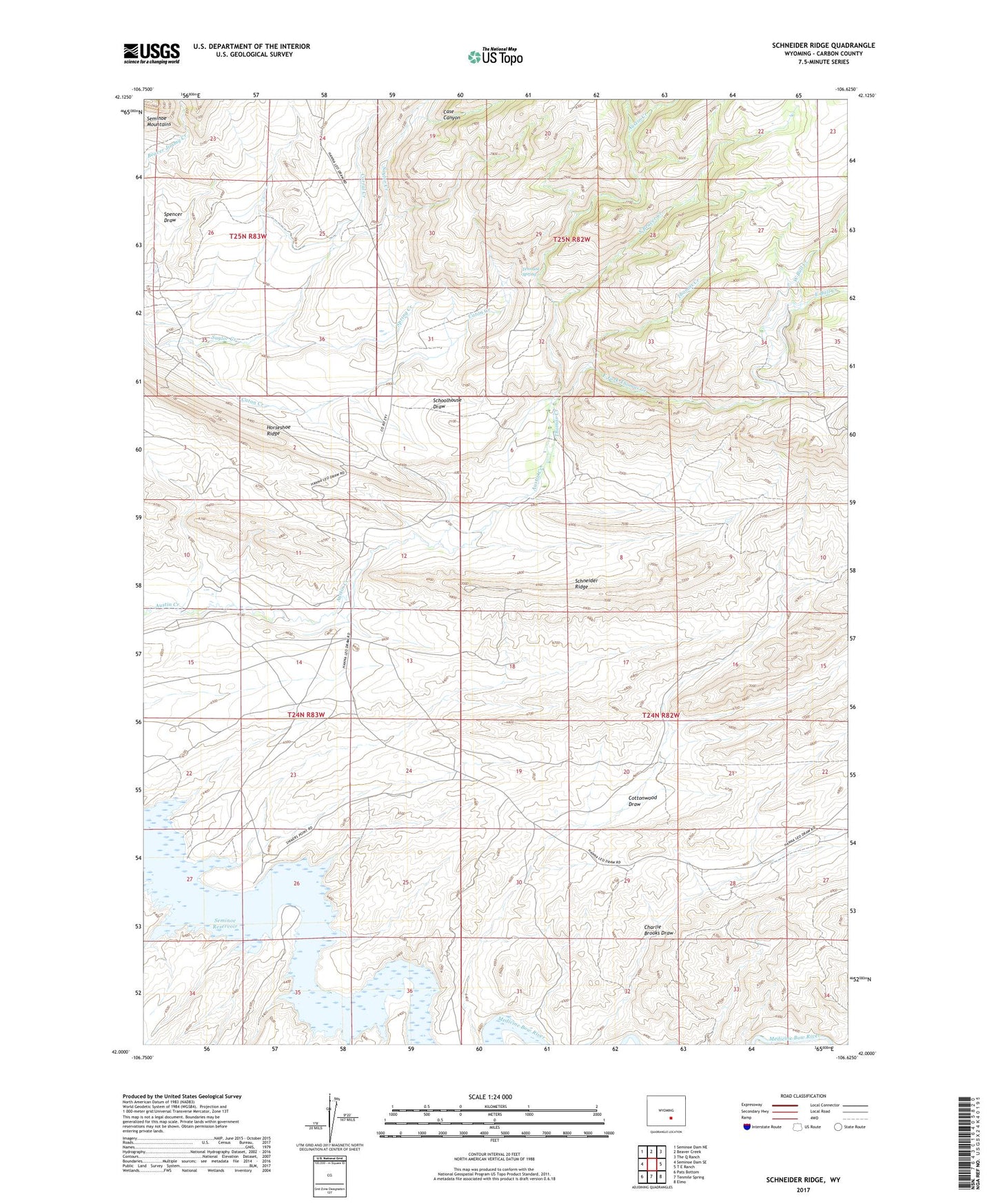
2021 topographic map quadrangle Schneider Ridge in the state of Wyoming. Scale: 1:24000. Based on the newly updated USGS 7.5' US Topo map series, this map is in the following counties: Carbon. The map contains contour data, water features, and other items you are used to seeing on USGS maps, but also has updated roads and other features. This is the next generation of topographic maps. Printed on high-quality waterproof paper with UV fade-resistant inks.
Quads adjacent to this one:
West: Seminoe Dam SE
Northwest: Seminoe Dam NE
North: Beaver Creek
Northeast: The Q Ranch
East: T E Ranch
Southeast: Elmo
South: Tenmile Spring
Southwest: Pats Bottom
This map covers the same area as the classic USGS quad with code o42106a6.
Contains the following named places: Annala Ranch, Atkinson Ranch, Bull Creek, Case Canyon, Caton Creek, Corral Creek, Cottonwood Draw, East Bull Creek, East Fork Thomas Creek, Evans Ranch, Huhtula Ranch, Matson Ranch, McNees Ranch, Pallesen Ranch, Schneider Ridge, Schoolhouse Draw, South Beaver Creek, Spring Creek, Tennant Spring, Thomas Creek, West Bull Creek