MyTopo
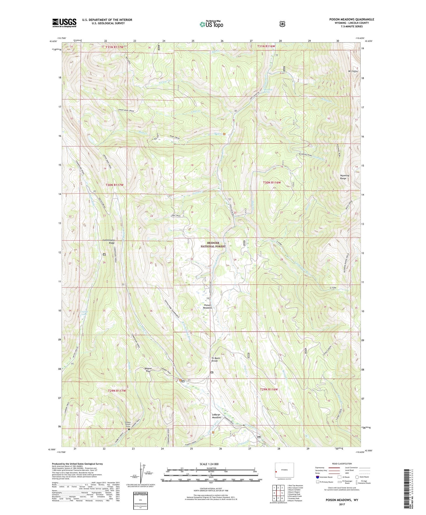
Poison Meadows Wyoming US Topo Map
Couldn't load pickup availability
Also explore the Poison Meadows Forest Service Topo of this same quad for updated USFS data
2021 topographic map quadrangle Poison Meadows in the state of Wyoming. Scale: 1:24000. Based on the newly updated USGS 7.5' US Topo map series, this map is in the following counties: Lincoln. The map contains contour data, water features, and other items you are used to seeing on USGS maps, but also has updated roads and other features. This is the next generation of topographic maps. Printed on high-quality waterproof paper with UV fade-resistant inks.
Quads adjacent to this one:
West: Mount Wagner
Northwest: Red Top Mountain
North: Box Canyon Creek
Northeast: Mount Schidler
East: Wyoming Peak
Southeast: Mount Thompson
South: Graham Peak
Southwest: Porcupine Creek
This map covers the same area as the classic USGS quad with code o42110e6.
Contains the following named places: Boco Creek, Clear Creek, Crystal Creek, Crystal Lake, Crystal Lake Recreation Site, East Fork Greys River, Estella Brown Grave, Kinney Creek, LaBarge Guard Station, LaBarge Meadows, Little Corral Creek, Lookout Creek, Mink Creek, Mount Coffin, North Clear Creek, Poison Creek, Poison Creek Mine, Poison Meadows, Shale Creek, Shot Hole Spring, Tri Basin Divide, Wagner Pass, West Fork Greys River