MyTopo
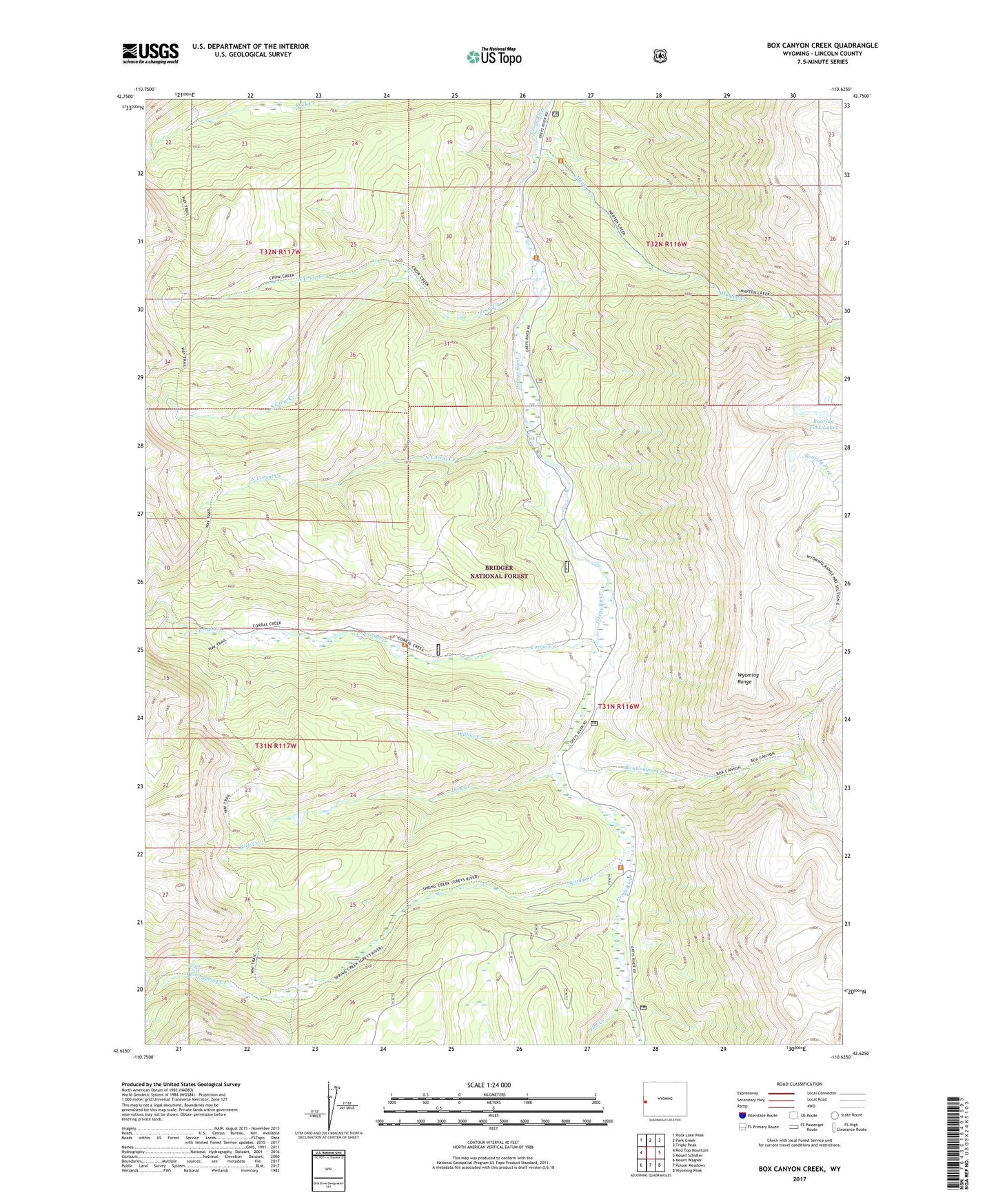
Box Canyon Creek Wyoming US Topo Map
Couldn't load pickup availability
Also explore the Box Canyon Creek Forest Service Topo of this same quad for updated USFS data
2021 topographic map quadrangle Box Canyon Creek in the state of Wyoming. Scale: 1:24000. Based on the newly updated USGS 7.5' US Topo map series, this map is in the following counties: Lincoln. The map contains contour data, water features, and other items you are used to seeing on USGS maps, but also has updated roads and other features. This is the next generation of topographic maps. Printed on high-quality waterproof paper with UV fade-resistant inks.
Quads adjacent to this one:
West: Red Top Mountain
Northwest: Rock Lake Peak
North: Park Creek
Northeast: Triple Peak
East: Mount Schidler
Southeast: Wyoming Peak
South: Poison Meadows
Southwest: Mount Wagner
This map covers the same area as the classic USGS quad with code o42110f6.
Contains the following named places: Box Canyon Creek, Bridger National Forest, Corral Creek, Corral Creek Guard Station, Crow Creek, Dick Creek, Flat Creek, Marten Creek, North Corral Creek, North Crow Creek, Roaring Fork Lakes, South Crow Creek, Spring Creek, Spring Creek Falls, Willow Creek, Wyoming Range Trail