MyTopo
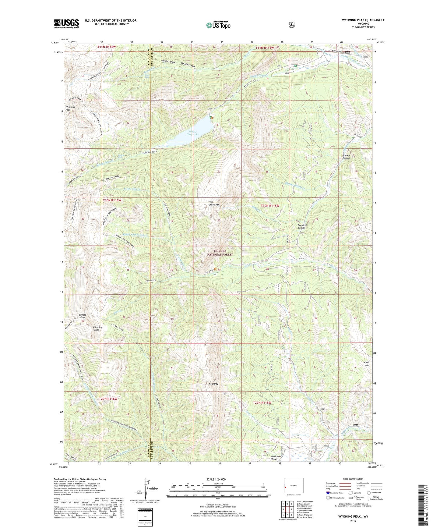
Wyoming Peak Wyoming US Topo Map
Couldn't load pickup availability
Also explore the Wyoming Peak Forest Service Topo of this same quad for updated USFS data
2021 topographic map quadrangle Wyoming Peak in the state of Wyoming. Scale: 1:24000. Based on the newly updated USGS 7.5' US Topo map series, this map is in the following counties: Sublette, Lincoln. The map contains contour data, water features, and other items you are used to seeing on USGS maps, but also has updated roads and other features. This is the next generation of topographic maps. Printed on high-quality waterproof paper with UV fade-resistant inks.
Quads adjacent to this one:
West: Poison Meadows
Northwest: Box Canyon Creek
North: Mount Schidler
Northeast: Red Castle Creek
East: Springman Creek
Southeast: Pine Grove Ridge
South: Mount Thompson
Southwest: Graham Peak
This map covers the same area as the classic USGS quad with code o42110e5.
Contains the following named places: Burney Canyon, Cheese Pass, Coal Creek, Darby Creek, Fish Creek Mountain, Lewis Falls, Marges Delight Creek, Middle Fork North Fish Creek, Middle Fork South Piney Creek, Middle Piney Dam, Middle Piney Lake, Middle Piney Lake Campground, Middle Piney Reservoir, Middle Piney Summer Home Area, Mount Darby, North Fork Fish Creek, North Fork South Piney Creek, North Mountain, Prospect Canyon, Sacajawea Campground, Straight Creek, TKC Claims, Walker Creek, Wohelo Falls, Wyoming Peak, Wyoming Range