MyTopo
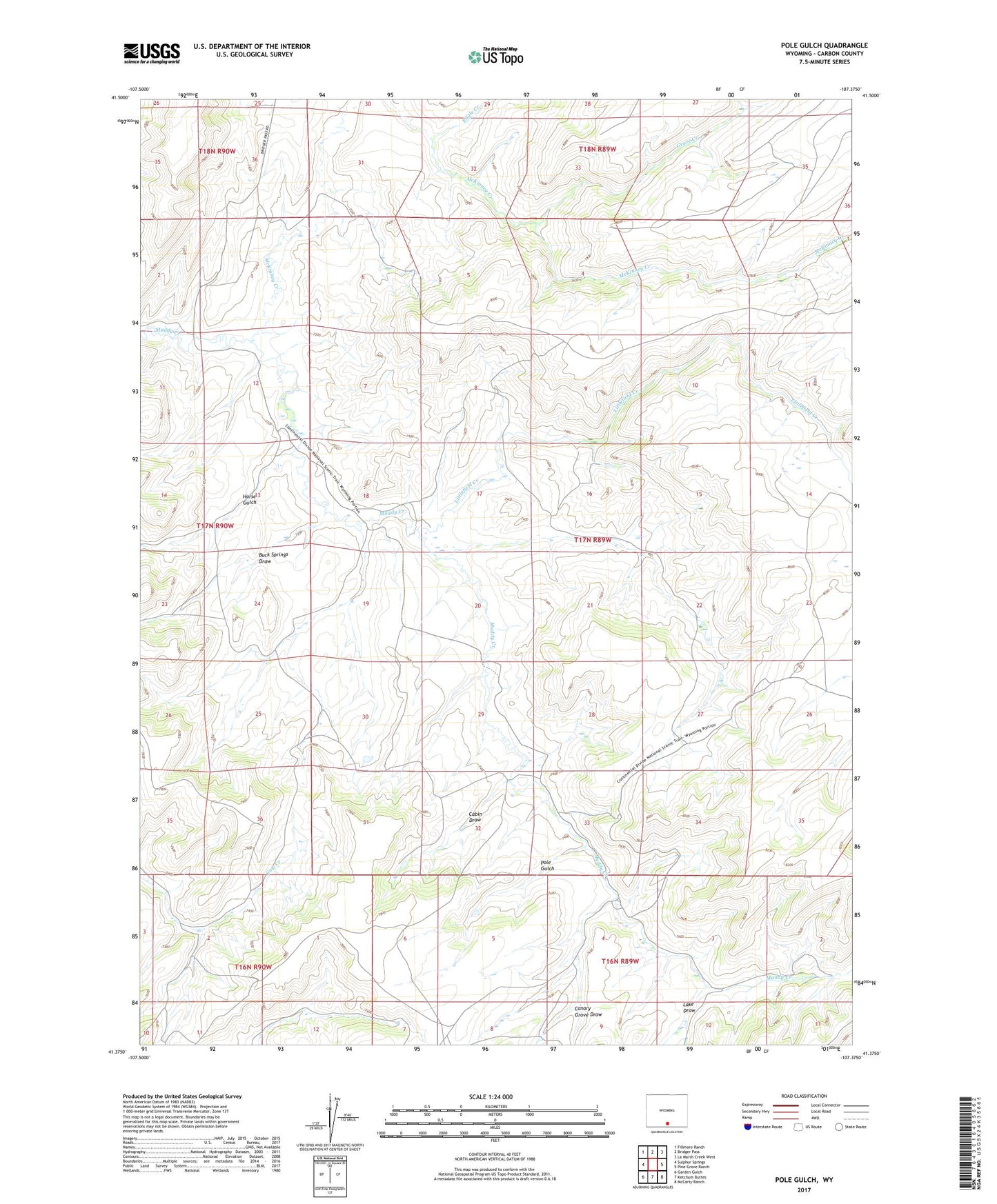
Pole Gulch Wyoming US Topo Map
Couldn't load pickup availability
2021 topographic map quadrangle Pole Gulch in the state of Wyoming. Scale: 1:24000. Based on the newly updated USGS 7.5' US Topo map series, this map is in the following counties: Carbon. The map contains contour data, water features, and other items you are used to seeing on USGS maps, but also has updated roads and other features. This is the next generation of topographic maps. Printed on high-quality waterproof paper with UV fade-resistant inks.
Quads adjacent to this one:
West: Sulphur Springs
Northwest: Fillmore Ranch
North: Bridger Pass
Northeast: La Marsh Creek West
East: Pine Grove Ranch
Southeast: McCarty Ranch
South: Ketchum Buttes
Southwest: Garden Gulch
This map covers the same area as the classic USGS quad with code o41107d4.
Contains the following named places: Buck Springs Draw, Cabin Draw, Canary Grove Draw, Eagle Creek, Emigrant Trail, Grove Creek, Horse Gulch, Lake Draw, Littlefield Creek, McKeil Homestead, McKinney Creek, Pole Gulch, Stoney Creek