MyTopo
Trabing Wyoming US Topo Map
Couldn't load pickup availability
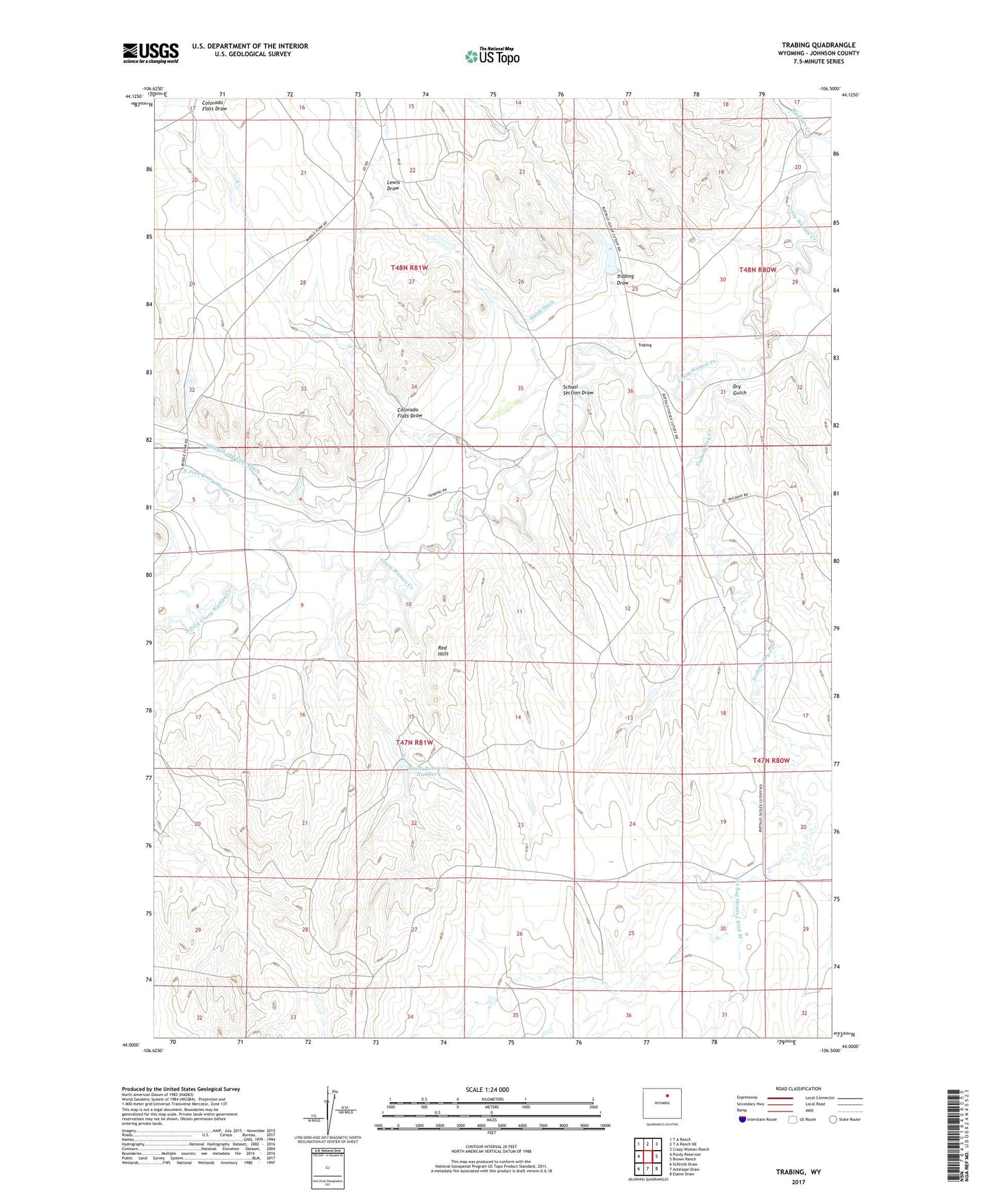
2021 topographic map quadrangle Trabing in the state of Wyoming. Scale: 1:24000. Based on the newly updated USGS 7.5' US Topo map series, this map is in the following counties: Johnson. The map contains contour data, water features, and other items you are used to seeing on USGS maps, but also has updated roads and other features. This is the next generation of topographic maps. Printed on high-quality waterproof paper with UV fade-resistant inks.
Quads adjacent to this one:
West: Purdy Reservoir
Northwest: T A Ranch
North: T A Ranch NE
Northeast: Crazy Woman Ranch
East: Brown Ranch
Southeast: Elaine Draw
South: Antelope Draw
Southwest: Schlicht Draw
This map covers the same area as the classic USGS quad with code o44106a5.
Contains the following named places: Baker Number 1 Reservoir, Bozeman Trail Historical Marker, Colorado Flats Draw, Crazy Woman Battlefield Historical Mark, Dry Gulch, Johnson County, Lewis Draw, Mitchell and Long Ditch, Red Hills, School Section Draw, Smith Ditch, Smith Number 1 Dam, Smith Reservoir Number 1, South Fork Crazy Woman Creek, Trabing, Trabing Dam, Trabing Draw, Trabing Dry Creek, Trabing Reservoir, Wallows Creek, West Fork Trabing Dry Creek, Zezas Dam, Zezas Reservoir