MyTopo
Ralston Wyoming US Topo Map
Couldn't load pickup availability
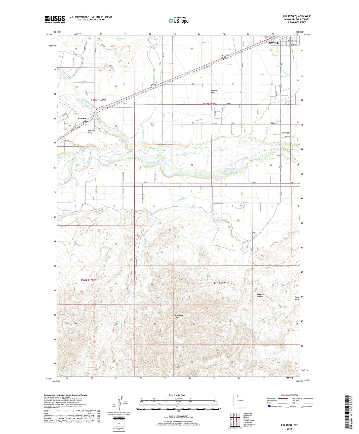
2021 topographic map quadrangle Ralston in the state of Wyoming. Scale: 1:24000. Based on the newly updated USGS 7.5' US Topo map series, this map is in the following counties: Park. The map contains contour data, water features, and other items you are used to seeing on USGS maps, but also has updated roads and other features. This is the next generation of topographic maps. Printed on high-quality waterproof paper with UV fade-resistant inks.
Quads adjacent to this one:
West: Vocation
Northwest: Elk Basin SW
North: Elk Basin SE
Northeast: Garland
East: Gilmore Hill NW
Southeast: Gilmore Hill
South: Stone Barn Camp
Southwest: Corbett Dam
This map covers the same area as the classic USGS quad with code o44108f7.
Contains the following named places: Alkali Creek Patch, Deer Creek, KPOW-AM (Powell), Lateral R, Lateral S, Lateral T, North Alkali Creek, O'Donnell, Powell Division, Ralston, Ralston Post Office, Southside Elementary School, Willwood, ZIP Code: 82440