MyTopo
Vocation Wyoming US Topo Map
Couldn't load pickup availability
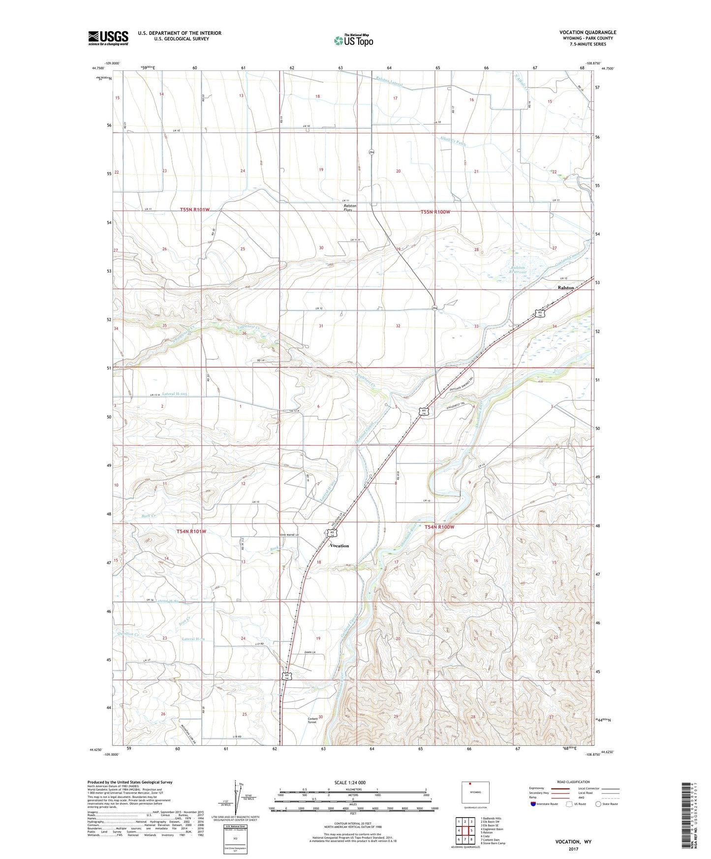
2021 topographic map quadrangle Vocation in the state of Wyoming. Scale: 1:24000. Based on the newly updated USGS 7.5' US Topo map series, this map is in the following counties: Park. The map contains contour data, water features, and other items you are used to seeing on USGS maps, but also has updated roads and other features. This is the next generation of topographic maps. Printed on high-quality waterproof paper with UV fade-resistant inks.
Quads adjacent to this one:
West: Eaglenest Basin
Northwest: Badlands Hills
North: Elk Basin SW
Northeast: Elk Basin SE
East: Ralston
Southeast: Stone Barn Camp
South: Corbett Dam
Southwest: Cody
This map covers the same area as the classic USGS quad with code o44108f8.
Contains the following named places: Buck Creek, Eaglenest, Eaglenest Creek, Emma Lanchbury Dam, Emma Lanchbury Reservoir, Garland Canal, Heart Mountain Relocation Center, Iron Creek, Kamms Corner, Lateral H-103, Lateral H-105, Lateral H-79, Lateral H-89, Question Creek, Ralston Census Designated Place, Ralston Lateral, Ralston Reservoir, South Eaglenest Creek, Vocation, Willwood Diversion Dam