MyTopo
Rattlesnake Draw Wyoming US Topo Map
Couldn't load pickup availability
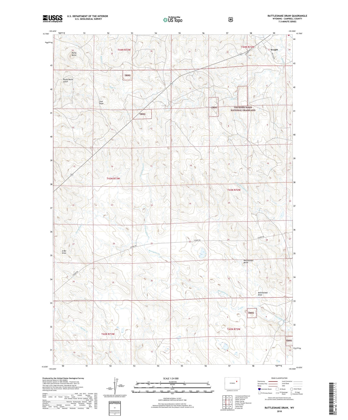
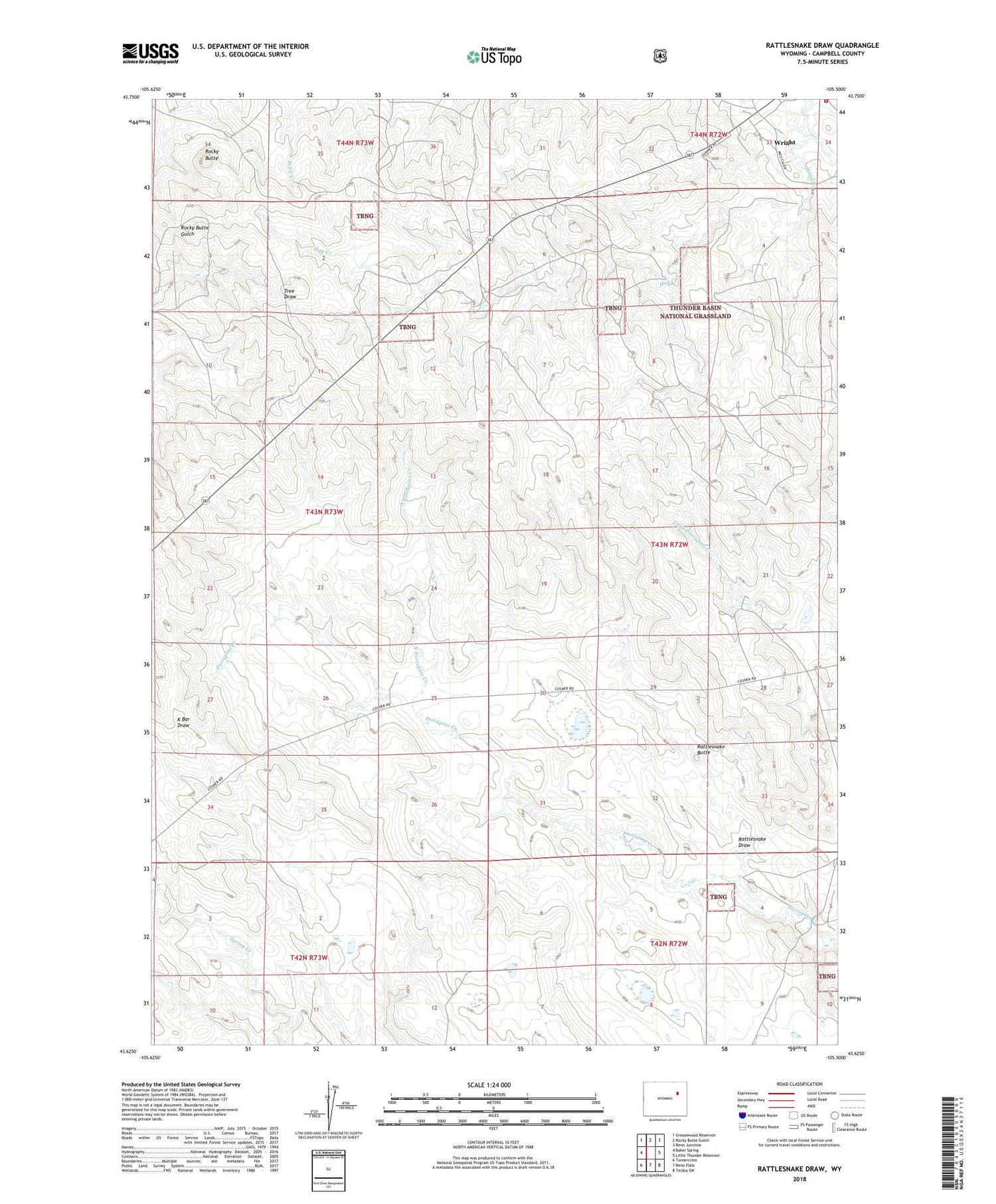
2021 topographic map quadrangle Rattlesnake Draw in the state of Wyoming. Scale: 1:24000. Based on the newly updated USGS 7.5' US Topo map series, this map is in the following counties: Campbell. The map contains contour data, water features, and other items you are used to seeing on USGS maps, but also has updated roads and other features. This is the next generation of topographic maps. Printed on high-quality waterproof paper with UV fade-resistant inks.
Quads adjacent to this one:
West: Baker Spring
Northwest: Greasewood Reservoir
North: Rocky Butte Gulch
Northeast: Reno Junction
East: Little Thunder Reservoir
Southeast: Teckla SW
South: Reno Flats
Southwest: Turnercrest
Contains the following named places: Campbell County Fire Department Station 9, Cosner Ranch, North Porcupine Creek, Patterson Ranch, Rattlesnake Butte, Rattlesnake Draw, Reno Dam, Reno Reservoir, Rocky Butte, Wright Ranch, ZIP Code: 82732