MyTopo
Rawhide Buttes West Wyoming US Topo Map
Couldn't load pickup availability
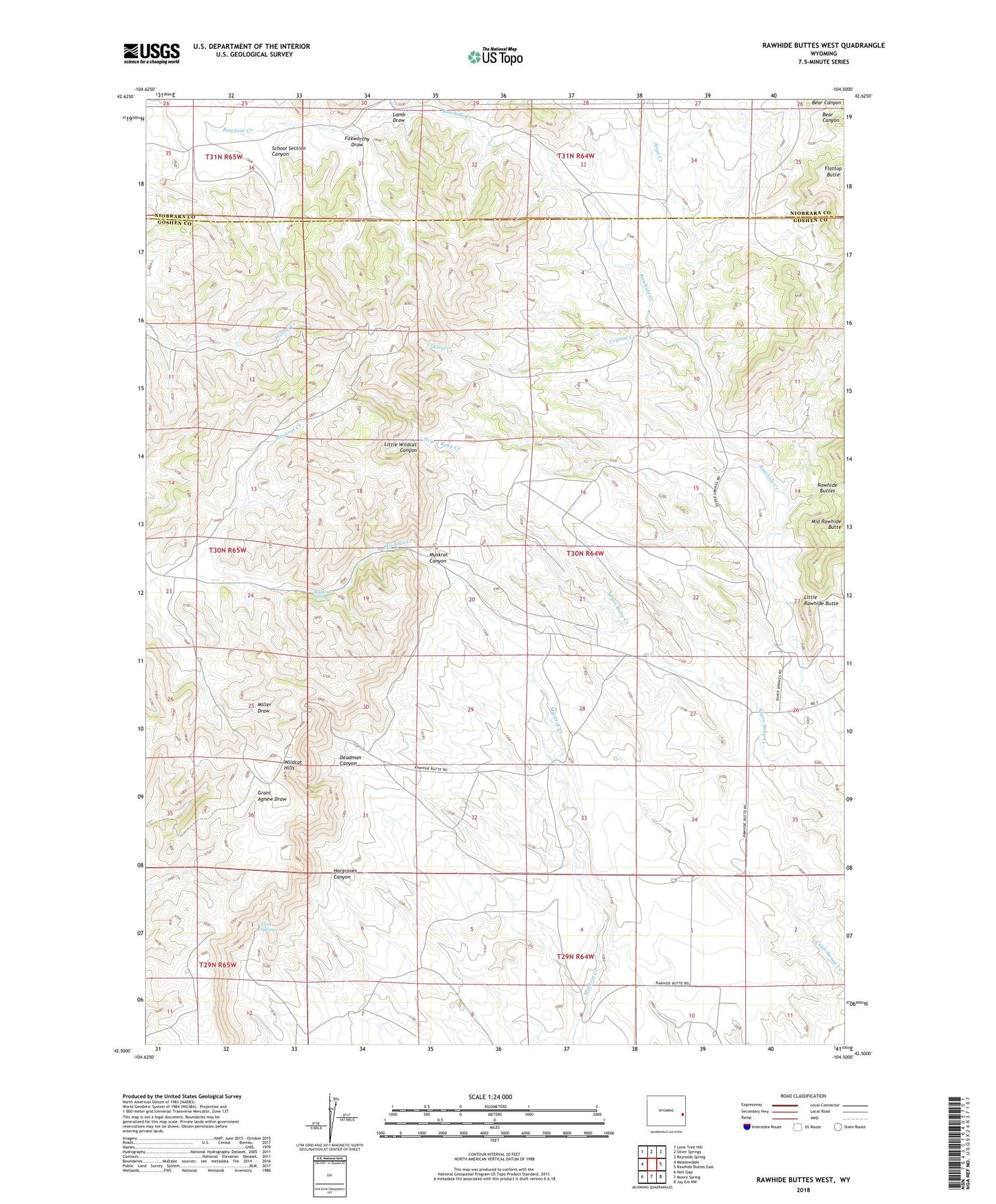
2021 topographic map quadrangle Rawhide Buttes West in the state of Wyoming. Scale: 1:24000. Based on the newly updated USGS 7.5' US Topo map series, this map is in the following counties: Goshen, Niobrara. The map contains contour data, water features, and other items you are used to seeing on USGS maps, but also has updated roads and other features. This is the next generation of topographic maps. Printed on high-quality waterproof paper with UV fade-resistant inks.
Quads adjacent to this one:
West: Meadowdale
Northwest: Lone Tree Hill
North: Silver Springs
Northeast: Reynolds Spring
East: Rawhide Buttes East
Southeast: Jay Em NW
South: Moore Spring
Southwest: Hell Gap
This map covers the same area as the classic USGS quad with code o42104e5.
Contains the following named places: Aego Creek, Copperbelt Mine, Crystal Creek, Deadman Canyon, Flattop Butte, Foxworthy Draw, Hargraves Canyon, Lamb Draw, Little Rawhide Butte, Little Wildcat Canyon, Michigan Mine, Muskrat Canyon, Muskrat Spring, Omaha Mine, School Section Canyon, Toms Well, Twin Springs