MyTopo
Moore Spring Wyoming US Topo Map
Couldn't load pickup availability
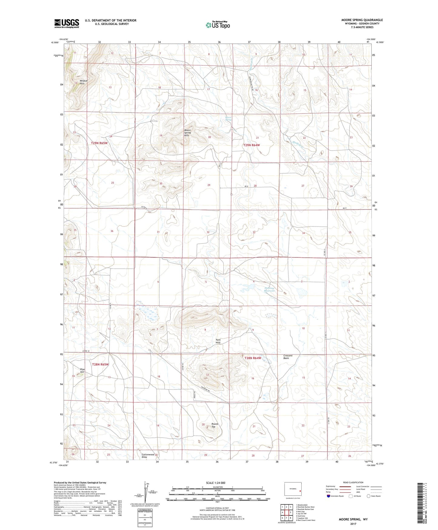
2021 topographic map quadrangle Moore Spring in the state of Wyoming. Scale: 1:24000. Based on the newly updated USGS 7.5' US Topo map series, this map is in the following counties: Goshen. The map contains contour data, water features, and other items you are used to seeing on USGS maps, but also has updated roads and other features. This is the next generation of topographic maps. Printed on high-quality waterproof paper with UV fade-resistant inks.
Quads adjacent to this one:
West: Hell Gap
Northwest: Meadowdale
North: Rawhide Buttes West
Northeast: Rawhide Buttes East
East: Jay Em NW
Southeast: Red Cloud Creek West
South: Casebier Hill
Southwest: Guernsey
This map covers the same area as the classic USGS quad with code o42104d5.
Contains the following named places: Bass Ranch, Baxter Ranch, Blevin Ranch, Copper Bottom Mine, Crescent Basin, Damrow Dam, Damrow Reservoir, Emma Ranch, Floyd Damrow Ranch, Fred Damrow Ranch, Hazelwood Ranch, Hoy Ranch, J Brown Ranch, K Brown Ranch, Moore Spring, Moore Spring Hills, Moore Spring School, Newell Ranch, Ollie Damrow Ranch, Pine Hill, Pugsley Ranch, Round Top, Twin Hills, Vandra Ranch, Wells Ranch, ZIP Code: 82219