MyTopo
Reed Reservoir Wyoming US Topo Map
Couldn't load pickup availability
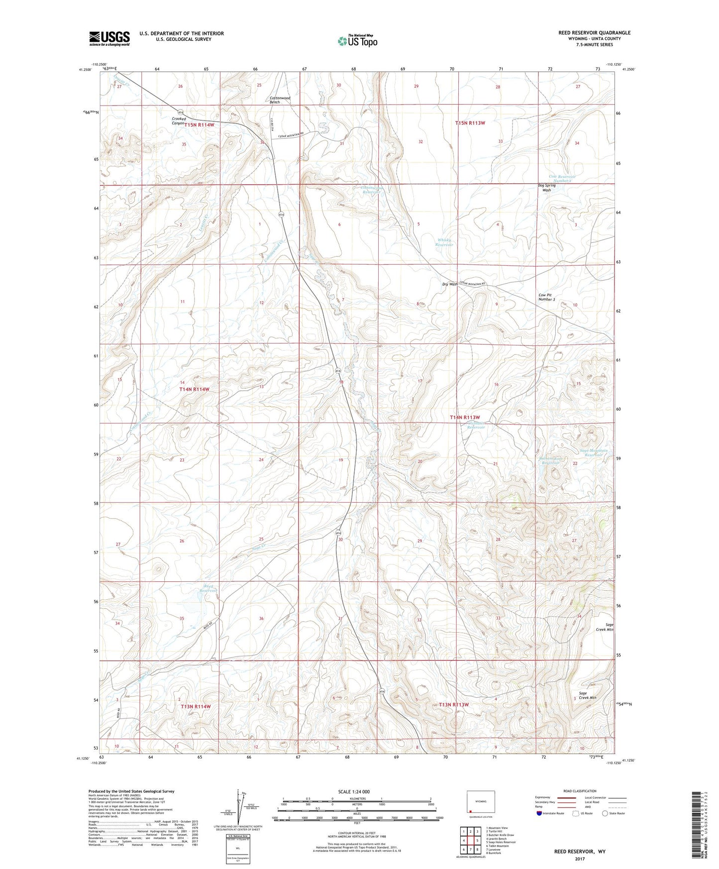
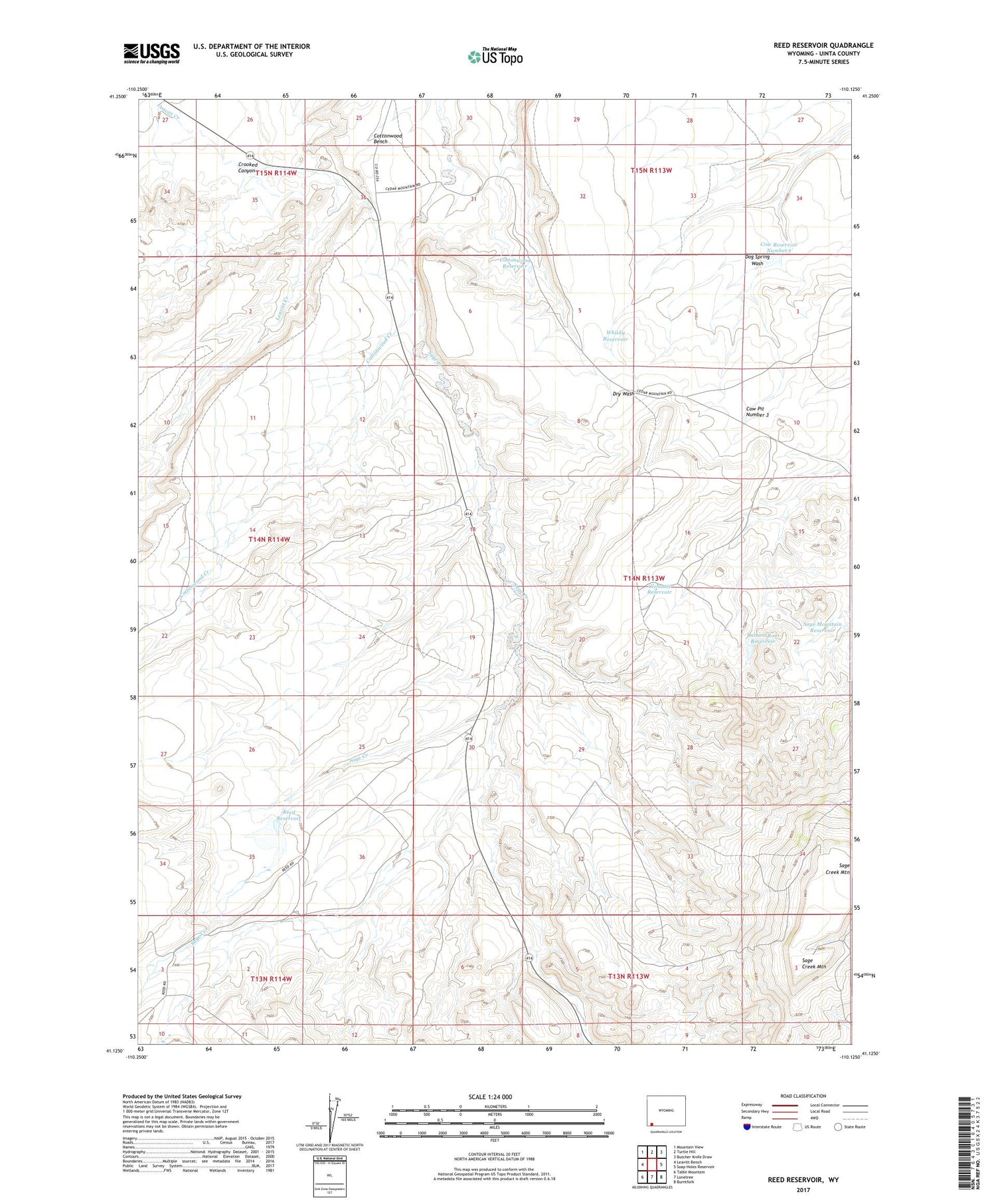
2021 topographic map quadrangle Reed Reservoir in the state of Wyoming. Scale: 1:24000. Based on the newly updated USGS 7.5' US Topo map series, this map is in the following counties: Uinta. The map contains contour data, water features, and other items you are used to seeing on USGS maps, but also has updated roads and other features. This is the next generation of topographic maps. Printed on high-quality waterproof paper with UV fade-resistant inks.
Quads adjacent to this one:
West: Leavitt Bench
Northwest: Mountain View
North: Turtle Hill
Northeast: Butcher Knife Draw
East: Soap Holes Reservoir
Southeast: Burntfork
South: Lonetree
Southwest: Table Mountain
Contains the following named places: Balsam Root Reservoir, Cedar Mountain Reservoir Number 7, Clematis Reservoir, Cottonwood Bench, Cottonwood Reservoir, Cow Pit Number 3, Cow Reservoir Number 1, Crooked Canyon, Dog Spring Wash, Reed Dam, Reed Reservoir, Sage Creek, Sage Creek Mountain, Sage Mountain Reservoir, Whisky Reservoir