MyTopo
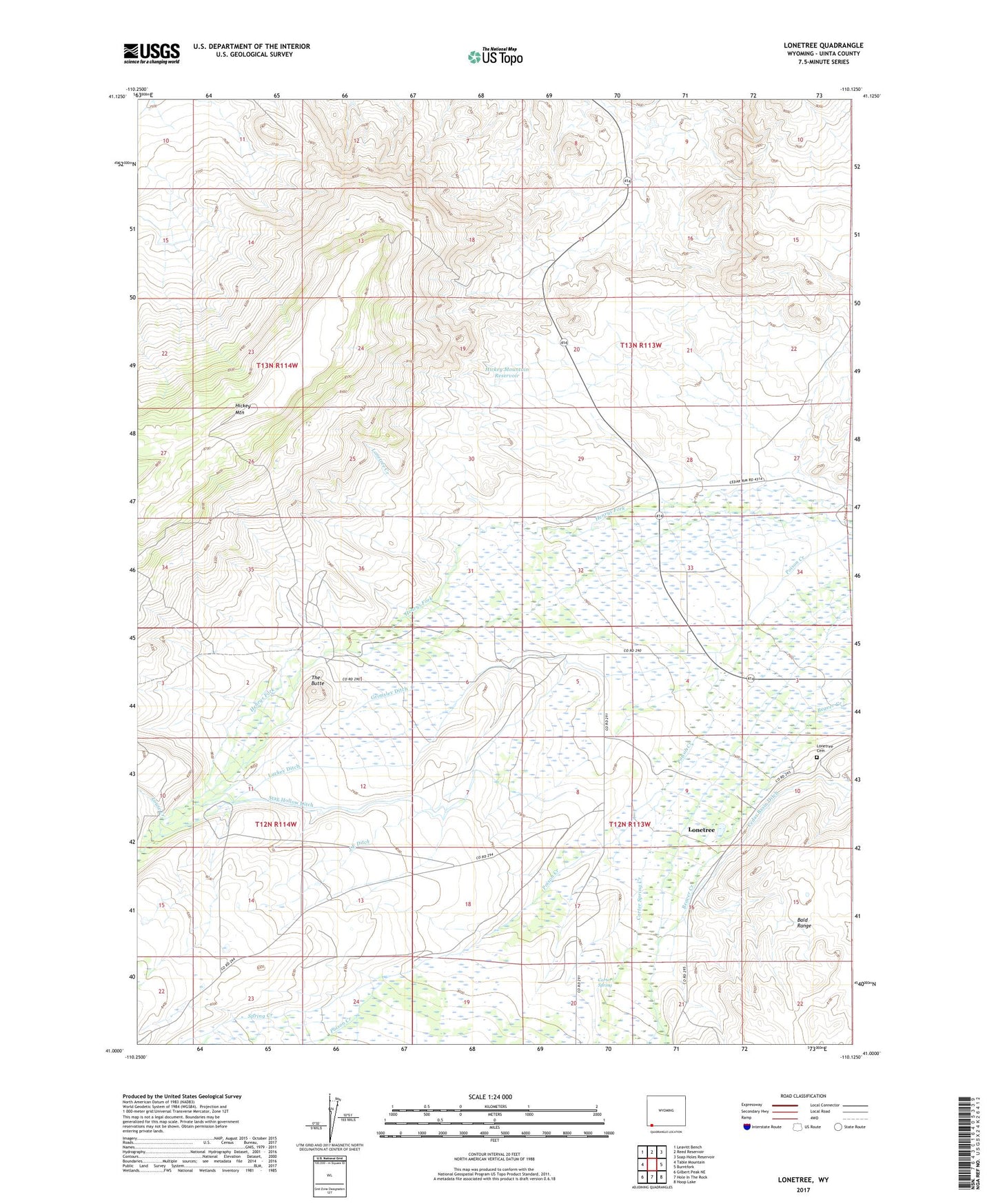
Lonetree Wyoming US Topo Map
Couldn't load pickup availability
Also explore the Lonetree Forest Service Topo of this same quad for updated USFS data
2021 topographic map quadrangle Lonetree in the state of Wyoming. Scale: 1:24000. Based on the newly updated USGS 7.5' US Topo map series, this map is in the following counties: Uinta. The map contains contour data, water features, and other items you are used to seeing on USGS maps, but also has updated roads and other features. This is the next generation of topographic maps. Printed on high-quality waterproof paper with UV fade-resistant inks.
Quads adjacent to this one:
West: Table Mountain
Northwest: Leavitt Bench
North: Reed Reservoir
Northeast: Soap Holes Reservoir
East: Burntfork
Southeast: Hoop Lake
South: Hole In The Rock
Southwest: Gilbert Peak NE
This map covers the same area as the classic USGS quad with code o41110a2.
Contains the following named places: Carter Spring, Carter Spring Creek, Cedar Basin Ditch, Grimsley Ditch, Hickey Mountain Reservoir, Hickey Ranch, J E Ditch, Lonetree, Lonetree Cemetery, Lonetree Census Designated Place, Lonetree Creek, Louse Creek, Luckey Ditch, Middle Fork Beaver Creek, Smith Ranch, Stag Hollow Ditch, The Butte, West Fork Beaver Creek, ZIP Code: 82936