MyTopo
Rock Springs Wyoming US Topo Map
Couldn't load pickup availability
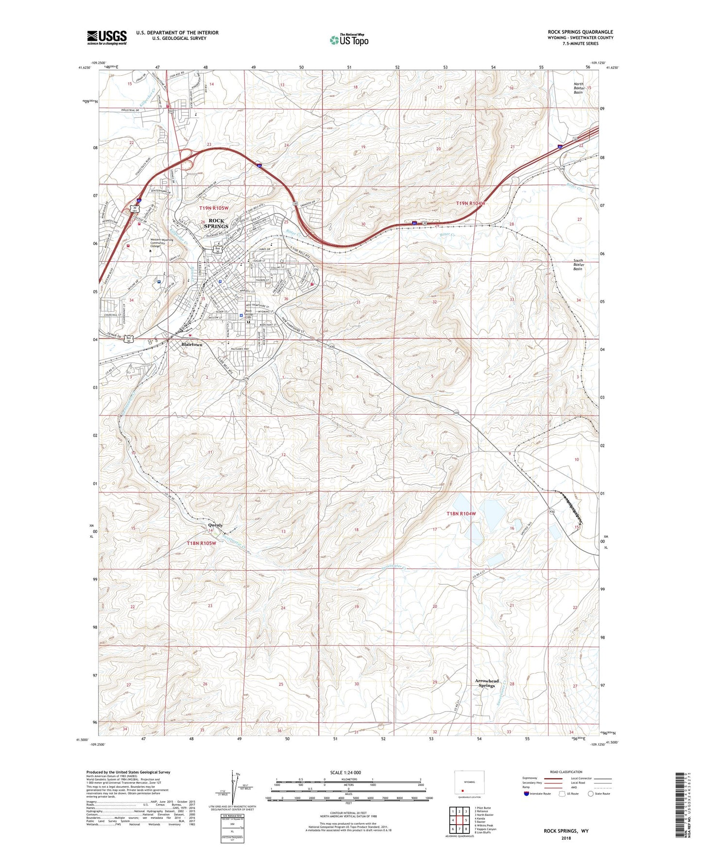
2021 topographic map quadrangle Rock Springs in the state of Wyoming. Scale: 1:24000. Based on the newly updated USGS 7.5' US Topo map series, this map is in the following counties: Sweetwater. The map contains contour data, water features, and other items you are used to seeing on USGS maps, but also has updated roads and other features. This is the next generation of topographic maps. Printed on high-quality waterproof paper with UV fade-resistant inks.
Quads adjacent to this one:
West: Kanda
Northwest: Pilot Butte
North: Reliance
Northeast: North Baxter
East: Baxter
Southeast: Lion Bluffs
South: Kappes Canyon
Southwest: Wilkins Peak
This map covers the same area as the classic USGS quad with code o41109e2.
Contains the following named places: Arrowhead Springs, Arrowhead Springs Census Designated Place, Blairtown, Bunning Park, City of Rock Springs, Killpecker Creek, KRKK-AM (Rock Springs), Lincoln School, Lowell School, Memorial Hospital of Sweetwater County, Pioneer Residential Treatment Center, Plaza Mall Shopping Center, Quealy, Rainbow Mine, Rock Springs, Rock Springs Cemetery, Rock Springs Fire Department Station 1, Rock Springs Fire Department Station 2, Rock Springs Fire Department Station 3, Rock Springs Regional Ambulance, Roosevelt School, Skorup Memorial Hospital Heliport, Swanson Mine, Sweetwater County Fire Department, Sweetwater County Fire District 1, Sweetwater Creek, Sweetwater Medics, Washington School, Western Wyoming Community College, White Mountain Mall, Wyoming Highway Patrol District 3 Division E, Yellowstone School