MyTopo
Rockypoint Wyoming US Topo Map
Couldn't load pickup availability
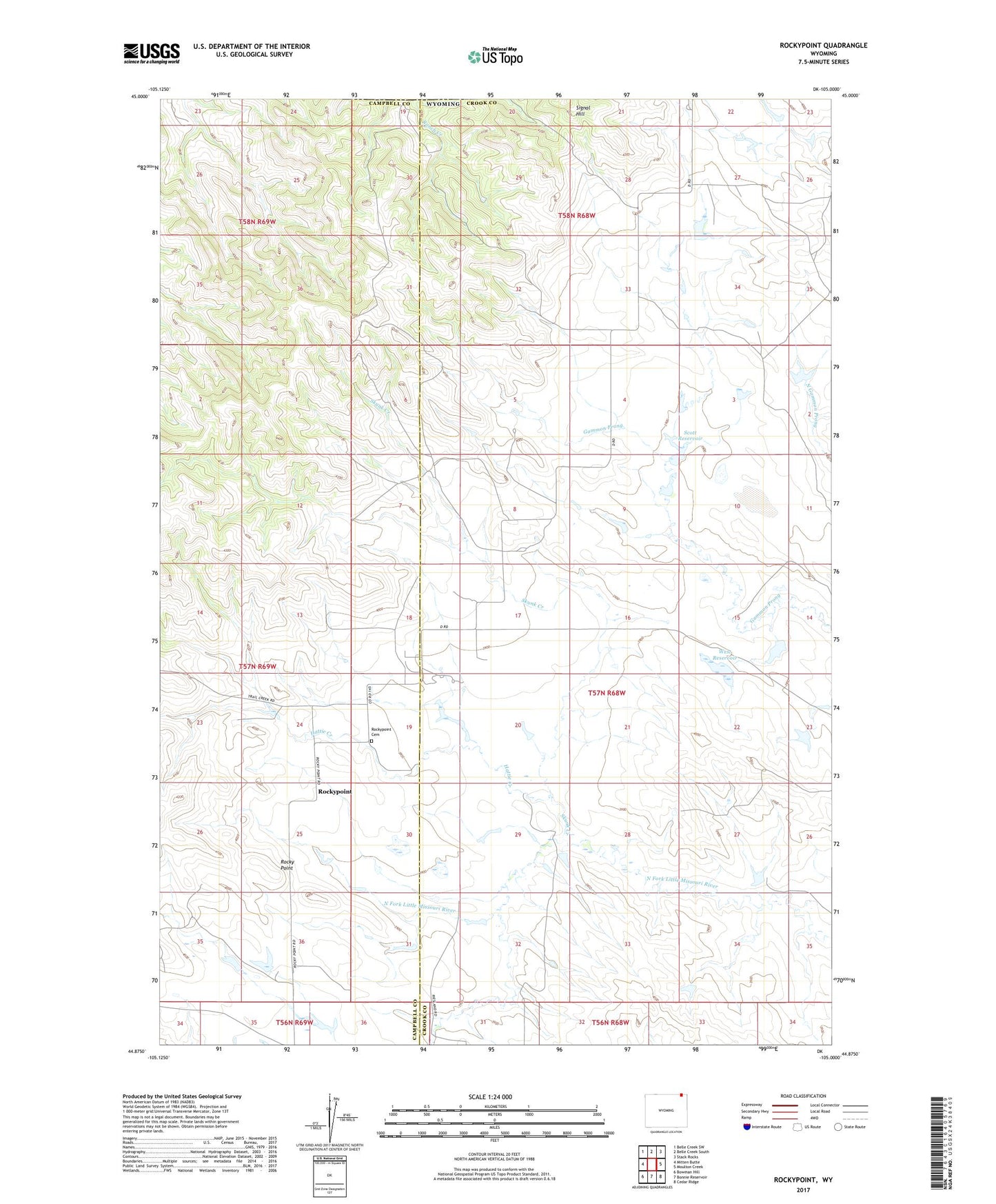
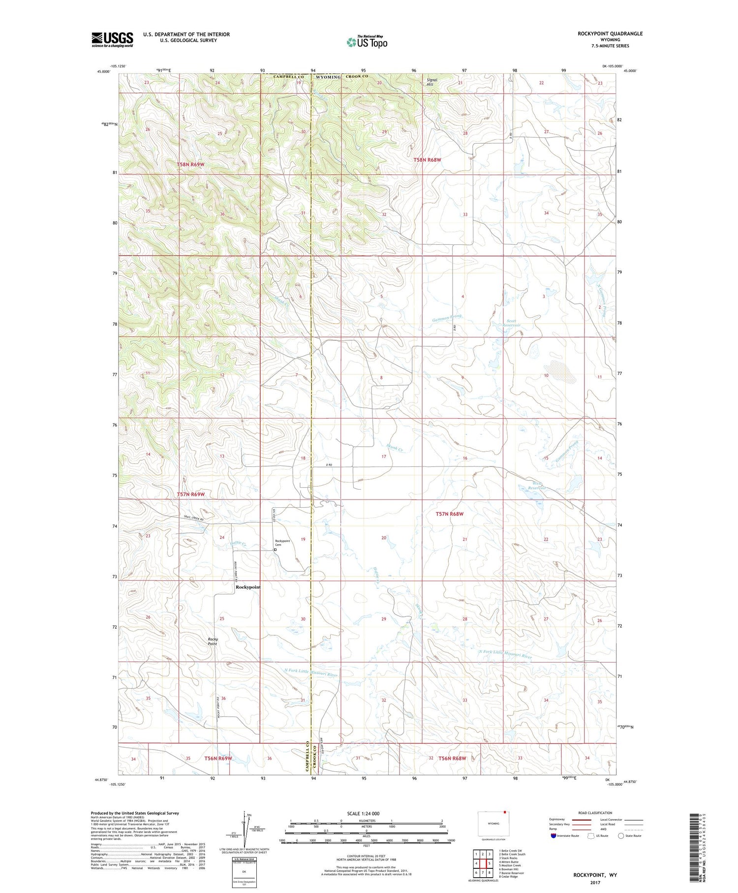
2021 topographic map quadrangle Rockypoint in the state of Wyoming. Scale: 1:24000. Based on the newly updated USGS 7.5' US Topo map series, this map is in the following counties: Crook, Campbell. The map contains contour data, water features, and other items you are used to seeing on USGS maps, but also has updated roads and other features. This is the next generation of topographic maps. Printed on high-quality waterproof paper with UV fade-resistant inks.
Quads adjacent to this one:
West: Mitten Butte
Northwest: Belle Creek SW
North: Belle Creek South
Northeast: Stack Rocks
East: Moulton Creek
Southeast: Cedar Ridge
South: Bonnie Reservoir
Southwest: Bowman Hill
Contains the following named places: Hattie Creek, Hill Dam, Hill Reservoir, Lightning Flat, Nebraska School, Parks Dam, Parks Reservoir, Rocky Point, Rockypoint, Rockypoint Cemetery, Rockypoint Church, Scott Reservoir, Signal Hill, Skunk Creek, The Lake Bed, West Dam, West Reservoir